Teacher Edition | View the Map
Week of March 26, 2023
Right click and SAVE AS
to download the Google Earth file for this episode
Use free Google Earth software
to OPEN it, using File> Open.
Find more tech info here.
Did you know that many people in European countries travel by train? It is so cool - if you travel by train, you can see two or even three countries in one day! Take a look at the attached maps. The first one shows the continent of Europe. What cardinal direction did we travel from Sweden to France? Take a look at the second map. This map shows the train routes throughout France. Can you see the connecting train routes from Paris? What countries are close enough to France that we could visit by train? Holy Idaho! There are a lot of trains out of Paris!
- Meri
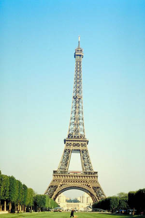
Here is a picture of the Eiffel Tower!
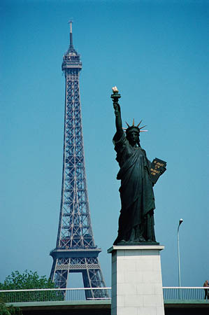
Here is another picture that I found of the Eiffel Tower. It also has a replica of the Statue of Liberty. I didn't know that France had two replicas of the Statue of Liberty. Did you know that?
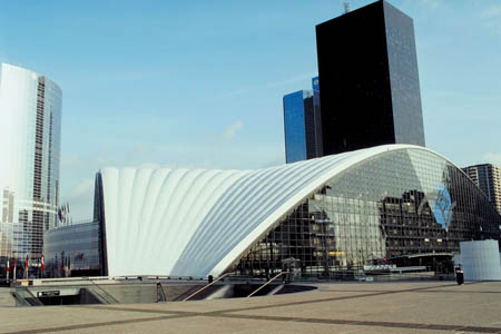
Look at this amazing picture that I found of some of the architecture of Paris.
Map of Europe
What cardinal direction did we travel flying from Sweden to France?
Map of the Train Routes in France
What countries surround France?
Meri and I went out sightseeing right at dusk. Paris is such a beautiful city. And France is a very interesting country. France is slightly smaller than the state of Texas. The land of France truly has it all. There are mountains (the Alps), flat plains, rolling hills in the north and west, dormant volcanoes, beautiful beaches, and more. Over 33% of the land of France is arable. Some of the delicious products grown in France include sugar beets, wheat, cereal, wine grapes, beef, potatoes, fish, dairy products, and others.
France also has numerous natural resources at their fingertips. Some of the most available natural resources include clay, gold deposits, tantalum, kaolin, petroleum, arsenic, coal, iron ore, bauxite, zinc, uranium, fish, timber, gypsum, fluorspar, and feldspar. I remember hearing about feldspar in other countries.
Meri researched the culture and religion of France online today. She found out that French is the official language of France, and 100% of French residents speak primarily French. Many people in France are Roman Catholic (about 85%). The second largest religion is Muslim (about 8%). I wonder if the religion of "Roman Catholic" is popular throughout all of Europe. What do you think?
We went to visit the Eiffel tower tonight (see our picture). Meri was so excited. The structure is amazing. Construction on this HUMONGOUS tower was started in 1887. It took the architects and engineers two years, two months, and five days to build the Eiffel Tower. The tower was built for the Universal Exposition, celebrating the 100th anniversary of the French Revolution. We attached a link with more information about the Eiffel Tower.
Text Message from Pandora - WAYN? It is hot here. RUOK? Call or text ASAP.
Text Message to Pandora - At Eiffel Tower
Text Message from Pandora - Seriously?
Text Message to Pandora - Yes. BBFN
Text Message from Pandora - U2 R so lucky!
Poor Pandora, I wish she could come to visit us for a few days. She is so bored at home. But her mouth runs a mile a minute, so she would never be able to keep the case "quiet." Uncle GT has given us permission to go explore England tomorrow! We will take the English Chunnel (or in French, le tunnel sous la Manche). Do you know what the English Chunnel is? I had to look it up - and what I found out was amazing. The Chunnel, completed in 1994, is an underground train tunnel underwater that connects France to England. It took over 15,000 workers to dig through this 7-year project! The construction cost more than $21 billion. But it was well worth the money, and it is used by many people daily. This rail tunnel is the 2nd largest rail tunnel in the world. The train we are taking is called the Eurostar, and it connects Paris to London. So, tomorrow - we will be in London! I can't wait. Maybe we'll see the royal family!
- Geo
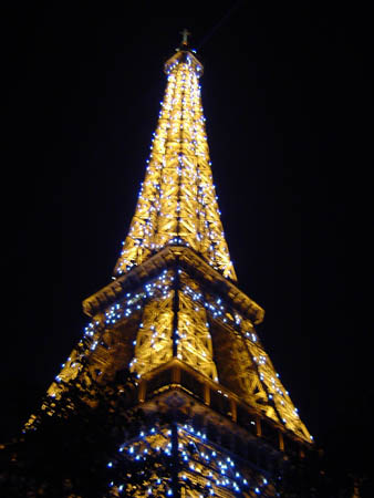
The Eiffel Tower - isn't it amazing at night! This is what it looked like from the street of the hotel. Photo used by permission. (c) 2004 E. B. Shively. All rights reserved.
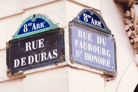
Here is a street sign that we took a picture of (because it was in French).
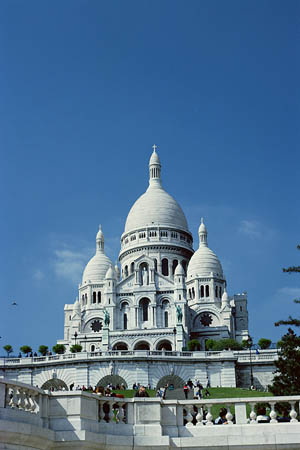
Here is a Cathedral we saw - the architecture is beautiful.
Tour the Eiffel Tower
Check out this virtual tour of the Eiffel Tower. Mr. Vuhn could only see the outside. It is closed inside, due to the pandemic.
Airpano
Take a virtual (360 degree) tour of the city of Paris!
Channel Tunnel (Chunnel) History for Kids
We found this cool video about the Chunnel, check it out.
The United Kingdom is located off of the mainland of Europe. The water in between is called the English Channel. It is kind of like an island. England has a temperate climate, with many rainy days. The Severn River is the longest river and largest river basin in the United Kingdom. But many people know about the Thames because it flows through London.
We just arrived in London, which is the capital city of England. London is one busy city! In fact, it is the largest city in England and one of the busiest and largest cities in the world! Holy Idaho! I can't believe all the neat places we have seen on our mission to find Dewey, the truth-sniffing dog! We will update our blog in a few hours. We are off to see the city of London!!
- Meri
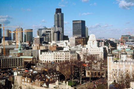
The city of London
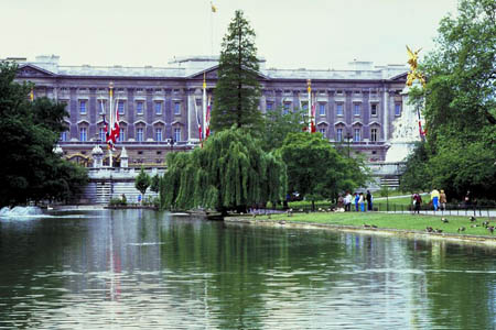
Here is a government building that we saw in London.
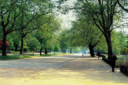
Here is a picture of a park in London.
United Kingdom Map
Here is a map of the United Kingdom. Can you locate the city of London?
- Meri
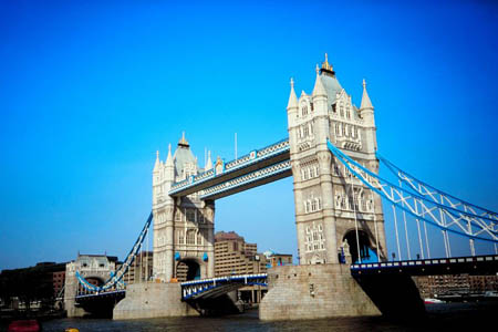
Tower Bridge
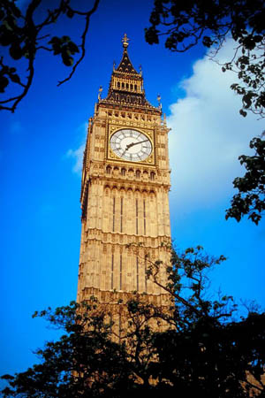
Big Ben
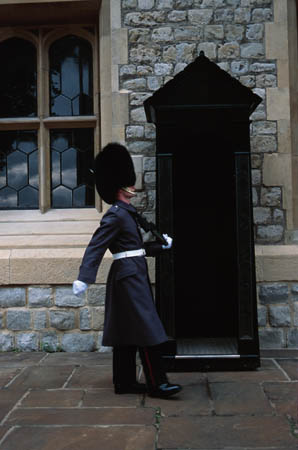
A guard at Buckingham Palace
London Sightseeing
View photos and learn more about each of the 3 options.
arable - land that can be used to grow crops.
cardinal direction - a term used to describe all four primary directions (north, south, east and west).
English Chunnel - an underground train tunnel that connects France to England. It took 7-years, 15,000 people, and $21 billion to complete. This rail tunnel is the 2nd largest rail tunnel in the world.
Feldspar - group of minerals found in crystals. They are usually white, red, blue, or green.
island - land that is surrounded on all sides by water.
natural resources - any substance that is made by nature and used to enhance the lives of living things. Some examples of natural resources include sunlight, minerals, soil, and water.
river basin - A river basin is the land that surrounds an area of water, where precipitaion (such as rain or snow) drains downhill into a body of water (a river in this case).
temperate - a climate that provides warm summers and mild winters. The temperatures do not typically get extremely hot or cold.
United Kingdom - located off of the mainland of Europe. The United Kingdom includes England, Northern Ireland, Scotland, and Wales. There are 60,000,000 people that live in the United Kingdom.
Grade 3-5: Knows the basic elements of maps and globes (title, legend, cardinal, scale, grid, meridians, time zones, etc.).
Grade 3-5: Knows major physical and human features of places as they are represented on maps and globes. Knows how to read different maps: road, relief, globe, etc..
Grade 3-5: Knows the approximate location of major continents, mountain ranges, and bodies of water on Earth.
Grade 6-8: Knows the location of physical and human features on maps and globes (e.g., culture hearths such as Mesopotamia, Huang Ho, the Yucatan Peninsula, the Nile Valley; major ocean currents; wind patterns; land forms; climate regions).
Grade 6-8: Knows the relative location of, size of, and distances between places.
Grade 3-5: Understands how changing transportation and communication technology has affected relationships between locations. Ease of travel between some and difficulty getting to some others because of transportation and how people move and shop from one to the other because of the ease (trains, road systems, ferries, etc...).
Grade 6-8: Understands distributions of physical and human occurrences with respect to spatial patterns, arrangements, and associations (e.g. why some areas are more densely settled than others).
Grade 6-8: Understands how places are connected and how these connections demonstrate interdependence and accessibility (such as - the role of the changing transportation and communication technology).
Grade 6-8: Knows the human characteristics of places (e.g., cultural characteristics such as religion, language, politics, technology, family structure, gender; population characteristics; land uses; levels of development).
Grade 6-8: Knows the physical characteristics of places (soil, vegetation, wildlife, etc..).
Grade 3-5: Knows the characteristics of a variety of regions (climate, housing, religion, language, etc..).
Grade 6-8: Understands criteria that give a region identity (such as Amsterdam as a transportation center or the Sunbelt's warm climate and popularity with retired people).
Grade 6-8: Knows how places and regions serve as cultural symbols (Opera House in Sydney or Tower Bridge in London).
Grade 3-5: Knows the physical components of Earth's atmosphere (weather and climate), lithosphere (land forms such as mountains), hydrosphere (oceans, lakes and rivers), and biosphere (vegetation and biomes).
Grade 3-5: Knows significant historical achievements of various cultures of the world (e.g., the Hanging Gardens or Babylon, the Taj Mahal in India, pyramids in Egypt, temples in ancient Greece, bridges and aqueducts in ancient Rome).
Grade 3-5: Knows how and why people divide Earth's surface into political and/or economic units (e.g., states in the United States and Mexico; provinces in Canada; countries in North and South America; countries linked in cooperative relationships, such as the European Union).
Grade 6-8: Understands the symbolic importance of capital cities (such as Canberra, a planned city, as the capital of Australia).