Teacher Edition | View the Map
Week of April 9, 2023
Right click and SAVE AS
to download the Google Earth file for this episode
Use free Google Earth software
to OPEN it, using File> Open.
Find more tech info here.
When we returned to our hotel room, I researched Geneva and Switzerland. This country differs from any other countries we visited on this mission. Switzerland is known as a "neutral" country. During its amazing history, Switzerland has settled many political disputes. There have been Geneva Conventions on the treatment of prisoners and many end-of-war Treaties. And did you know that Geneva isn't even the capital city of Switzerland? The capital is Bern. The United Nations has a big presence in Geneva. It has a long history of international diversity and neutrality. It is so cool. Did you know you can take a BOAT in Geneva like you can take buses, trains, or taxis in other parts of the world? In fact, the lake boats are actually part of the transit system.
The climate in Switzerland is fairly temperate, but it really varies with the altitude. Do you remember what altitude means? Speaking of altitude, boy, does Switzerland have some amazing mountains! There are the Alps in the south and Jura Mountains in the northwest. Central Switzerland has plateaus and rolling hills. And there are beautiful large lakes (remember - part of the transit system). The main natural resources of Switzerland include hydropower, salt, and timber.
Switzerland has some natural hazards too - landslides, flash floods, and avalanches. I know what a flash flood is, but I am unsure about a landslide or avalanche. Meri researched and found that a landslide is when the earth, rocks, or debris flows on slopes due to gravity. I guess they are more common here because of all of the hills and mountains. An avalanche is very similar to a landslide, but instead of just earth, rocks, and debris sliding down slopes, an avalanche involves SNOW. When an avalanche occurs, a very large slab of snow slides down a mountain.
- Geo
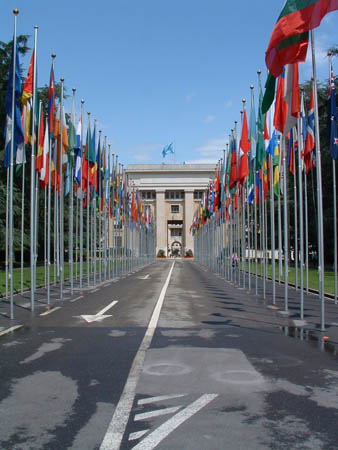
United Nations In Geneva - Photo used by permission. (c) 2004 D. W. Shively. All rights reserved.
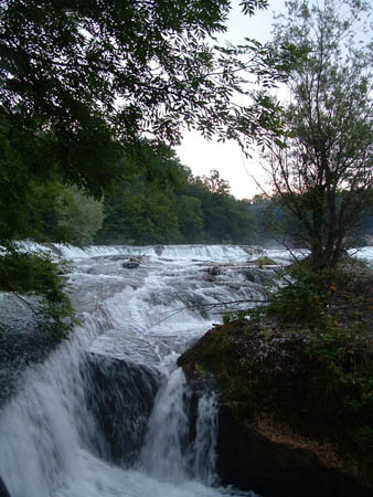
The Rhinefalls. Photo used by permission. (c) 2004 D. W. Shively. All rights reserved.
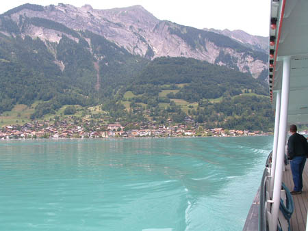
Here is the view from a boat ride that we took on Lake Geneva. Photo used by permission. (c) 2004 D. W. Shively. All rights reserved.
Switzerland Information
This link provides a ton of information about Switzerland.
Switzerland by Train
This map shows the train routes through Switzerland. Can you find Geneva? Can you find the capital city? What is the capital city of Switzerland? What countries border Switzerland? What cardinal direction do you travel going from the capital city to Geneva?
Switzerland Virtual Tours
Click on one of the red dots to take a virtual tour of several cities in Switzerland.
In our seminar, we met two teenagers who were there as student ambassadors from their countries. Ania was a girl we met from Poland, and Angelo was from Florence, Italy. During our morning break, we got to talk to Ania and Angelo about their home countries. It was so exciting to learn about places we have never been to. I wish we could see Italy and Poland, but we must continue our mission to find Dewey, the truth-sniffing dog. We did post some pictures in our blog that Angelo and Ania shared with us.
Ania taught us some pretty cool stuff about Poland. Many of my friends have ancestors from Poland, so I found it all fascinating! Poland is found in central Europe (east of Germany). Unlike Switzerland, a lot of Poland is mostly a flat plain. There are some mountains on the southern tip of the country. Poland has a wealth of arable land - over 40%! Holy Idaho! This might be the most "arable" country we have learned about so far. Ania's family is actually farmers. In fact, 16% of Polish people are farmers. I wonder what percentage of Americans are farmers? Ania explained that many products are grown in Poland, including fruits, wheat, vegetables, potatoes, poultry, pork, eggs, dairy, and others.
Then Angelo showed us pictures of his hometown - Florence, Italy. Holy Idaho! It is beautiful, maybe the most beautiful land we have seen yet! Italy is located in Southern Europe on a peninsula that extends into the Mediterranean Sea. The city of Florence is located in central Italy (not on the coast). The capital of Italy is Rome. Holy Idaho! The country of Italy is about the same size as Arizona (a little larger). It is shaped differently (a "boot" instead of a rectangle), but the overall land size is very close. Angelo told us that Italy has many natural resources - natural gas and crude oil reserves, pumice, fluorspar, mercury, coal, zinc, marble, feldspar, and numerous others. He was very proud to tell us that Florence is considered a treasure in art because of its history of many famous Renaissance artists. Do you know any?
- Meri
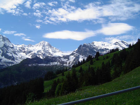
The amazing Alps! Photo used by permission. (c) 2004 E. B. Shively. All rights reserved.
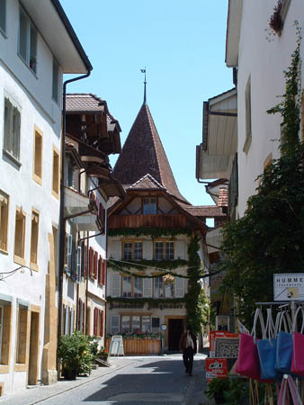
The Swiss village of Merten Photo used by permission. (c) 2004 D. W. Shively. All rights reserved.
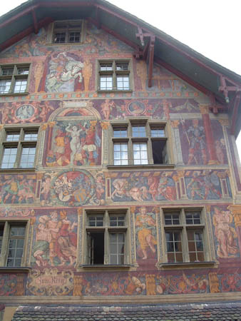
Check out this neat painted house that we saw in Switzerland. Photo used by permission. (c) 2004 D. W. Shively. All rights reserved.
- Meri
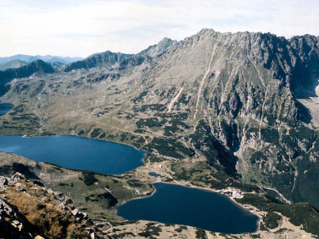
The Tatra Mountains in Poland
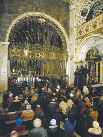
The Chapel of Madonna (the church Ania attends)
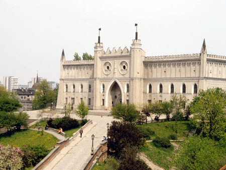
The Lublin Castle in Poland - isn't it amazing!
- Meri
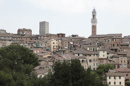
The skyline of Florence, Italy
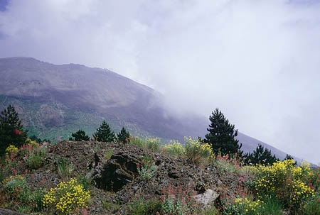
The beautiful landscape of Florence, Italy.
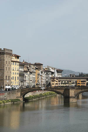
The water and a bridge in Florence, Italy
- Geo
Tour Antarctica\'s Palmer Station
Watch this short video to learn more about Palmer Station.
altitude - how high land is above (or below) sea level.
arable - land that can be used to grow crops.
avalanche - a massive movement of large slabs of snow that slide down the sides of a mountain.
landslide - the downward flow of earth, rocks, and debris from a slope or hill due to gravity.
Natural hazards - extreme weather and/or other conditions caused by nature. Some examples include volcanoes, earthquakes, blizzards, tornadoes, droughts, tsunamis, and typhoons.
natural resources - any substance that is made by nature and used to enhance the lives of living things. Some examples of natural resources include sunlight, minerals, soil, and water.
Oceania - A region that is made up of many islands and countries. Oceania is divided into four sub-regions. Each of the regions includes numerous islands. The regions are Australasia, Polynesia, Micronesia, and Melanesia. Australia is the largest country in Oceania.
peninsula - a piece of land that is bordered by water (on three or more sides), but is not an island. A peninsula is attached to a larger body of land but sticks out into the water.
temperate - a climate that provides warm summers and mild winters. The temperatures do not typically get extremely hot or cold.
United Nations - established in 1945, after the end of World War II. There are nearly 200 countries from around the world represented in the United Nations. The goals of the U.N. are to protect and promote peace, security, and economic stability throughout the world.
Back to top
Grade 3-5: Knows the basic elements of maps and globes (title, legend, cardinal, scale, grid, meridians, time zones, etc.).
Grade 3-5: Knows major physical and human features of places as they are represented on maps and globes. Knows how to read different maps: road, relief, globe, etc..
Grade 3-5: Knows the approximate location of major continents, mountain ranges, and bodies of water on Earth.
Grade 6-8: Knows the location of physical and human features on maps and globes (e.g., culture hearths such as Mesopotamia, Huang Ho, the Yucatan Peninsula, the Nile Valley; major ocean currents; wind patterns; land forms; climate regions).
Grade 6-8: Knows the relative location of, size of, and distances between places.
Grade 3-5: Understands how changing transportation and communication technology has affected relationships between locations. Ease of travel between some and difficulty getting to some others because of transportation and how people move and shop from one to the other because of the ease (trains, road systems, ferries, etc...).
Grade 6-8: Knows the physical characteristics of places (soil, vegetation, wildlife, etc..).
Grade 3-5: Knows the characteristics of a variety of regions (climate, housing, religion, language, etc..).
Grade 6-8: Understands criteria that give a region identity (such as Amsterdam as a transportation center or the Sunbelt's warm climate and popularity with retired people).
Grade 6-8: Knows how places and regions serve as cultural symbols (Opera House in Sydney or Tower Bridge in London).
Grade 3-5: Knows the physical components of Earth's atmosphere (weather and climate), lithosphere (land forms such as mountains), hydrosphere (oceans, lakes and rivers), and biosphere (vegetation and biomes).
Grade 3-5: Knows significant historical achievements of various cultures of the world (e.g., the Hanging Gardens or Babylon, the Taj Mahal in India, pyramids in Egypt, temples in ancient Greece, bridges and aqueducts in ancient Rome).
Grade 6-8: Knows the consequences of a specific physical process operating on Earth's surface (e.g., effects of an extreme weather phenomenon such as a hurricane's impact on a coastal ecosystem, effects of heavy rainfall on hill slopes, effects of the continued movement of Earth's tectonic plates).
Grade 3-5: Knows plants and animals associated with various vegetation and climatic region on Earth (i.e. kinds of plants and animals found in the rainforests of Africa).
Grade 6-8: Understands the symbolic importance of capital cities (such as Canberra, a planned city, as the capital of Australia).
Grade 3-5: Knows how communities benefit from the physical environment (e.g., people make their living by farming on fertile land, fishing in local water, working in mines; the community is a port located on a natural harbor, a tourist center located in a scenic or historic area, an industrial center with good access to natural resources).
Grade 3-5: Knows natural hazards that occur in the physical environment (floods, tornadoes, earthquakes, etc..).
Grade 6-8: Knows how the physical environment affects life in different regions (e.g., how people in Siberia, Alaska, and other high-latitude places deal with the characteristics of tundra environments; limitations to coastline settlements as a result of tidal, storm, and erosional processes).