Teacher Edition | View the Map
Week of April 16, 2023
Right click and SAVE AS
to download the Google Earth file for this episode
Use free Google Earth software
to OPEN it, using File> Open.
Find more tech info here.
Marine biology is the focus of the scientific research at Palmer Station. They also have a radio receiver that studies lightning over the western hemisphere. What continents are in the western hemisphere? (Hint- we attached a map to help you out). Palmer Station is also located near some unique animals: penguin colonies, fur seals, leopard seals, elephant seals, orcas, humpback whales, and other really cool animals. We have some pictures of the animals below. I wonder whether the animals are there in winter. Yes, it is almost winter right now in Antarctica. Do you remember why?
Guess where Meri and I are flying next? If you guessed Palmer Station, you are correct! We are actually on a flight from Geneva to London right now. From London, we are flying to Australia (yes, back to Australia). The only flights into Antarctica this week are from Australia. Our flight is landing in London now. Meri will update our blog later tonight. We attached some really "cool" pictures of ice (in Antarctica).
- Geo
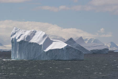
An iceberg- right side up. This one has not flipped yet and is very jagged. Does it remind you of any landforms? Photo used by permission. A© Copyright 2007 W. Pomeroy. All rights reserved.
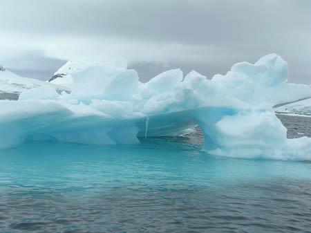
Look at the neat shape of the ice. The blue color is caused by the dense packing of the ice, making light refract differently and appear more blue. What shapes do you see? Photo used by permission. A© Copyright 2007 W. Pomeroy. All rights reserved.
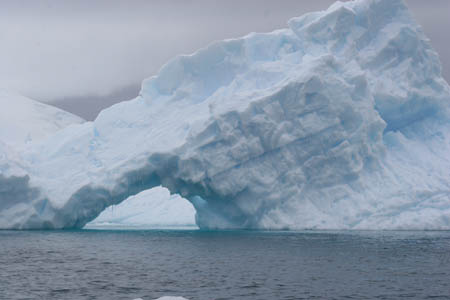
Another iceberg! Photo used by permission. © Copyright 2007 W. Pomeroy. All rights reserved.
Palmer Station
Learn more about Palmer Station at this blog.
Map of Western Hemisphere
What continents are in the western hemisphere?
A tour of Palmer Station, Antarctica | ANTARCTICA
We have been learning a lot about Antarctica. Did you know that the South Pole was located in Antarctica? The continent is about 1.5 times the size of the United States. It is about 14 million square kilometers. Most of the continent is south of the Antarctic Circle. The Antarctic Circle is an imaginary line (similar to the equator) that is found around 66 00 South latitude. Do you remember what imaginary line is found at 0 degrees latitude?
Many countries have "claims" on parts of Antarctica, similar to the way Palmer Station is owned by the United States. Some of the other countries with "claims" include Australia, Argentina, the United Kingdom, Chile, and others. The continent of Antarctica has a population of ZERO. But, some researchers reside there for the summers, winters, or both.
There is NO arable land in Antarctica. In fact, it is a DESERT! Imagine that -- an Arctic desert. Where else did we see huge deserts? Antarctica is the coldest, driest, and windiest continent in the world. The continent has many natural resources: chromium, nickel, platinum, gold, coal, iron ore, and many others. Do you think that is why Phoebe is interested in Antarctica?
- Meri
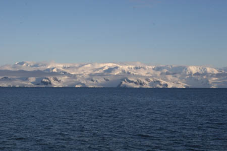
Here is a picture approaching the Antarctic peninsula. Photo used by permission. ? Copyright 2007 W. Pomeroy. All rights reserved.
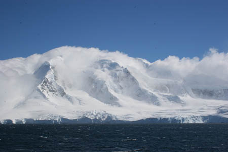
Here is another picture of the Antarctic peninsula. Photo used by permission. ? Copyright 2007 W. Pomeroy. All rights reserved.
- Geo
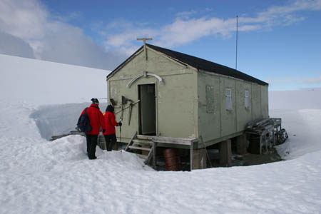
Here is a picture we found online of one of the buildings at Palmer Station. I can't wait to get there! Photo used by permission. ? Copyright 2007 W. Pomeroy. All rights reserved.
- Meri
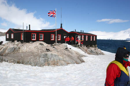
Here is a picture of South Georgia Island. What does the flag represent? This building had a post office and small gift shop. Photo used by permission. ? Copyright 2007 W. Pomeroy. All rights reserved.
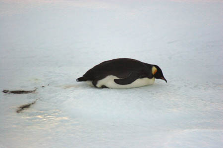
Check out this Emperor Penguin. It was floating on an iceberg as we were landing!! These penguins are around all year. Photo used by permission. ? Copyright 2007 W. Pomeroy. All rights reserved.
- Geo
Antarctic Circle - The Antarctic Circle is an imaginary line (similar to the equator) that is found around 66 00 South latitude.
arable - land that can be used to grow crops.
latitude - the lines that run across (east and west) a map. Lines of latitude measure degrees via north or south. The equator is at 0 degrees latitude.
natural resources - any substance that is made by nature and used to enhance the lives of living things. Some examples of natural resources include sunlight, minerals, soil, and water.
Palmer Station - Palmer Station is a United States research center located in Antarctica. The U.S. has three research centers in Antarctica. Palmer Station is the only one located north of the Antarctica Circle.
United Kingdom - located off of the mainland of Europe. The United Kingdom includes England, Northern Ireland, Scotland, and Wales. There are 60,000,000 people that live in the United Kingdom.
western hemisphere - all land and water west of the prime meridian.
Back to top
Grade 3-5: Knows the basic elements of maps and globes (title, legend, cardinal, scale, grid, meridians, time zones, etc.).
Grade 3-5: Uses map grids (e.g., latitude and longitude or alphanumeric system) to plot absolute location.
Grade 6-8: Understands concepts such as axis, seasons, rotation, and revolution.
Grade 3-5: Knows major physical and human features of places as they are represented on maps and globes. Knows how to read different maps: road, relief, globe, etc..
Grade 3-5: Knows the approximate location of major continents, mountain ranges, and bodies of water on Earth.
Grade 6-8: Knows the location of physical and human features on maps and globes (e.g., culture hearths such as Mesopotamia, Huang Ho, the Yucatan Peninsula, the Nile Valley; major ocean currents; wind patterns; land forms; climate regions).
Grade 6-8: Knows the relative location of, size of, and distances between places.
Grade 3-5: Understands how changing transportation and communication technology has affected relationships between locations. Ease of travel between some and difficulty getting to some others because of transportation and how people move and shop from one to the other because of the ease (trains, road systems, ferries, etc...).
Grade 3-5: Knows different methods to measure data (miles, kilometers, time, etc..).
Grade 6-8: Understands distributions of physical and human occurrences with respect to spatial patterns, arrangements, and associations (e.g. why some areas are more densely settled than others).
Grade 6-8: Knows the human characteristics of places (e.g., cultural characteristics such as religion, language, politics, technology, family structure, gender; population characteristics; land uses; levels of development).
Grade 6-8: Knows the physical characteristics of places (soil, vegetation, wildlife, etc..).
Grade 3-5: Knows how Earth's position relative to the Sun affects events and conditions on Earth.
Grade 6-8: Knows how the physical environment affects life in different regions (e.g., how people in Siberia, Alaska, and other high-latitude places deal with the characteristics of tundra environments; limitations to coastline settlements as a result of tidal, storm, and erosional processes).