
Technical Information and Tips
Globetracker offers several engaging options (links, maps, and resources) to help students to connect with the story and locations. We have included instructions for using these additional features.
Links to Learn More:
Most of the links that you will be opening for Globetracker will be links for maps. However, we do include some links in many episodes to learn more about geography concepts, locations, landmarks, and more. These links are underlined and found at the end of one of the blog entries. For example, the link below Grand Canyon - For Kids, is easily opened by clicking the title. These sites all open in a new window/tab, making them easy to pop open whenever you want to share. We suggest resizing the window to your desired size. While these extra activities/websites are optional, they do offer students a bit more of a complete picture of the locations and geography concepts.
Links to Maps:
Globetracker uses three types of maps within each episode.
-
Map links within episodes open in a new window/tab so you can continue reading the mission and look at the maps at the same time. If Geo and Meri have asked questions about what students see in the map, it is best to resize and position the new window so you can see the questions: as well:
-
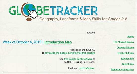
There are two types of Google Maps found at the beginning of each episode
The first one is a Google MyMaps. To access the Google MyMap, simply click the map title next to the date (in this case, Introduction Map). You may also see this map worded Week One Map, Week Two Map, etc. The link to download the Google Earth map file is also found at the top of the weekly story.
If you have never used Google MyMaps, they are simple to use and require no download, no saving, no account. Just click the link and open. While Google Earth does offer a few additional features, Google MyMaps offer a great (and simple) alternative.
To begin, open the map by clicking the title. The map will show the travel and locations occurring in the episodes. Follow the image guide with each location (city, airport, desert, etc..) The map includes a scale and an easy way to increase (+) or decrease (-) the zooming feature on the map. All of the specific locations are listed on the left sidebar.
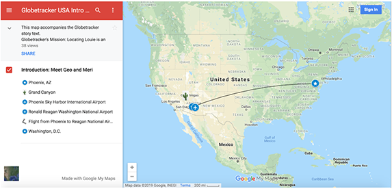
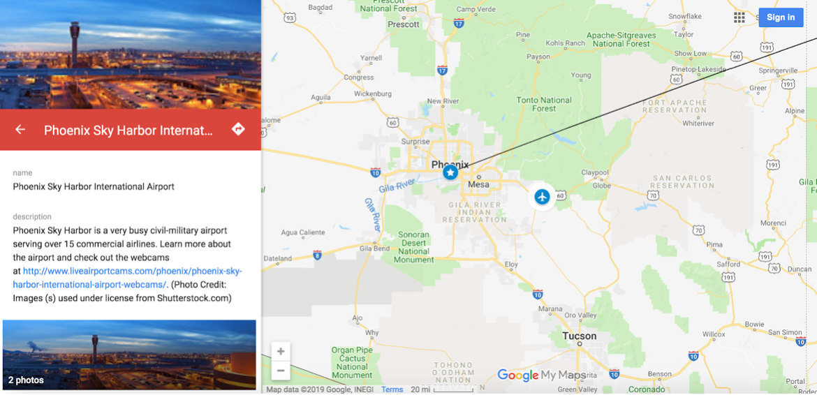
You can click on one of the locations on the left sidebar to view images about the location, read more information, and even find additional links for more information. This is a great way to “show” your students the culture of the area. Use the extra links as time permits.
 One of the best things about Google MyMaps is being able to "drag" using the little hand to see what is above, below, left, and right, just as if you were sliding the paper around behind a window opening. This tool is great fun on an interactive whiteboard. Hold your finger on the map and drag...its magic! Have students drag to show you what is north, south, east, and west. They may learn the cardinal directions much more quickly via kinesthetic experience.
 -
The final type of maps are Google Earth maps. Here too, you have a choice. You can view the maps on Google Earth Web (available only on the Google Chrome browser) or you can download Google Earth Pro. Let’s talk about the features of both options.
To make navigating the information easier, we have created pages with instructions for each Google Earth Map option.
Click here to view the Tech Information for using Google Earth Web.
Click here to view the Tech information for Google Earth Pro
Following Geo and Meri on X (formerly Twitter)
View Geo and Meri's recent X posts in the sidebar of each episode. They often post during the week when they don't have time to write a whole new blog entry. To follow their posts without visiting their blog (and to follow others, such as @teachersfirst), you will need a free X account. Many teachers set up a class X account. Once you create an account, follow @SFLGlobeTracker.
For extra fun, why not log into your class X account and send Geo and Meri a message by specifically MENTIONING them in a tweet/post. To do this, write a post and include @SFLGlobeTracker. Geo and Meri might respond directly to your class. Some examples of tweets/posts Geo and Meri will receive and read:
Did @SFLGlobeTracker find any clues in the museum?
Is it cold where Dewey is @SFLGlobeTracker?
@SFLGlobeTracker What do homes look like in Peru?
Watch your X account or Geo and Meri's blog posts for responses!