Teacher Edition | View the Map
Week of February 12, 2023
Right click and SAVE AS
to download the Google Earth file for this episode
Use free Google Earth software
to OPEN it, using File> Open.
Find more tech info here.
We have kept ourselves busy exploring Hong Kong. We can't read most of the signs because they are in Chinese. Holy Idaho! Hong Kong is so cool. Geo and I knew very little about Hong Kong before arriving, but we have already learned much. Did you know that Hong Kong is actually a Special Administrative Region (referred to as a SAR) of the People's Republic of China? China has another Special Administrative Region - Macau. Neither Hong Kong nor Macau is actually a country. A SAR (Special Administrative Region) has its own government, but it is still under another country's overall jurisdiction (China). This is similar to a territory in the USA. Hong Kong encompasses over 260 islands and peninsulas in the South China Sea.
The term "Hong Kong" translates to "fragrant harbor." Hong Kong seems to be a cultural mix of China and western civilization. The term western civilization refers to the modern cultures of North America and Western Europe (comes from western hemisphere). Hong Kong began as a trading port (back in the 19th century), but it has become a leading world financial center. Holy Idaho! I guess they called the area Hong Kong since it began as a trading port. If the term translates to the fragrant harbor, I wonder if the port had a particular scent. Actually, the water today is fragrant, but not in a nice way. It smells pretty bad. I think there is a lot of nasty pollution and unhealthy stuff in the harbor. Nowadays, the main things that are exported from Hong Kong include clocks, watches, textiles, clothing, electronics, plastics, and toys. I wonder if toys that say "Made In China" could be made and exported from Hong Kong. What do you think? Hong Kong is PART of China - so maybe?
The official language of Hong Kong is Chinese. Over 90% of those people living in Hong Kong are Chinese. And 90% of all residents in Hong Kong practice local religions rather than those we know from other parts of the world, such as Judaism, Islam, and Christianity. The natural resources of Hong Kong include feldspar and an incredible deepwater harbor. I have never heard of feldspar. Geo discovered that feldspar is a name given to a group of minerals found in crystals. They are usually white, red, blue, or green. Geo found a picture of feldspar (see below).
The weather in Hong Kong has been very rainy. The climate is a subtropical monsoon. It is warm and sunny in the fall, humid and cool in the winter, and hot and rainy in the spring and summer. About 5% of the land in Hong Kong is arable. Some of Hong Kong's main agricultural products include fish, pork, fresh vegetables, and poultry. I guess the deepwater harbor and coastline allow for some excellent fishing! The only major natural hazard in Hong Kong is occasional typhoons. They do have other environmental concerns - mainly the air. You see, the city is busy and highly populated - in fact, there are more than 6,200 people per square kilometer. That isn't as crowded as New York City, but is still a lot of people! Since so many people live and work in Hong Kong, the air quality isn't so clean. There is a lot of smog (fog that has become polluted by mixing with smoke). We haven't noticed the smell or smog very much, but it is a concern of the people who live in Hong Kong. Okay, we are heading back out to explore Hong Kong. We will update our blog tomorrow.
- Meri
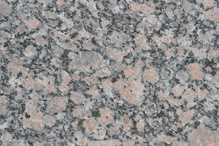
Feldspar
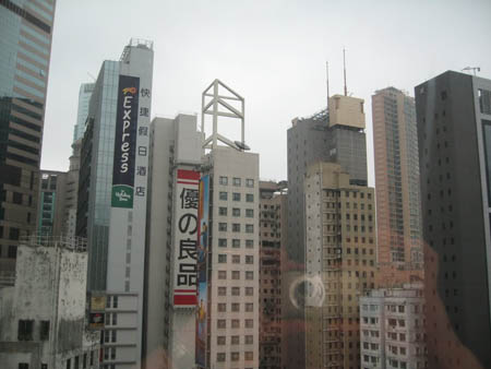
Downtown Hong Kong (Photo by Christopher Shively)
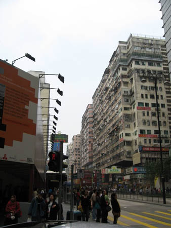
Another picture of downtown (Photo by Christopher Shively)
One day in Hong Kong: 360° Virtual Tour with Voice Over
Check out this virtual tour of Hong Kong. We learned a lot from the video.
We do have one little update from Uncle GT. He just called, and Mrs. Thomas contacted him. She was suspicious about our visit a few days ago. Uncle GT told her that we meant no harm and were just researching different career options. She seemed to believe him. Wow - that was a close call.
- Geo
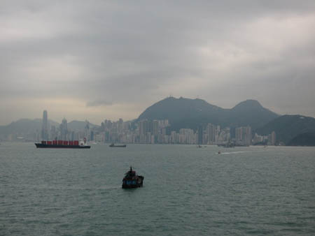
The (fragrant) Hong Kong Harbor (Photo by Christopher Shively)
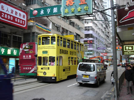
A neat mode of transportation in this busy city. (I would want to sit on the top level.) (Photo by Christopher Shively)
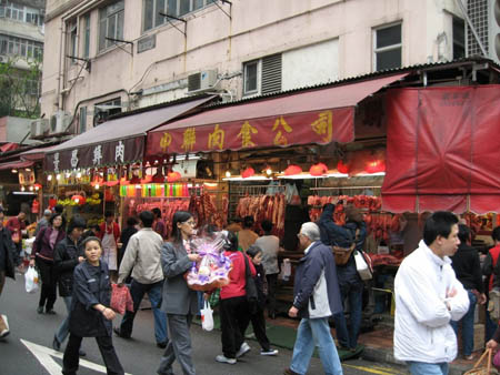
Here is an area that people can go shopping in Hong Kong. (Photo by Christopher Shively)
Travel For Kids: Hong Kong
This excellent website provides a ton of information about Hong Kong. Learn about food, shopping, and tourist locations. The website also provides a list of fun books that teach about Hong Kong.
- Meri
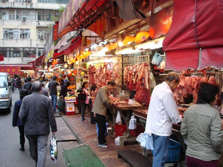
The busy city of Hong Kong (Photo by Christopher Shively)
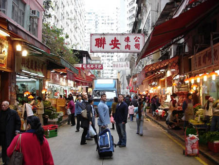
Another picture of the city (Photo by Christopher Shively)
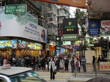
Another picture of downtown Hong Kong (Photo by Christopher Shively)
Map of Asia
We depart soon from Hong Kong and have a 12-hour layover in Thailand before arriving in India. Hong Kong is located in southwest China. Can you find China, Thailand, and India? What cardinal direction will we be traveling?
arable - land that can be used to grow crops.
exported - when a crop (or another product) is sent or transported to another country (for money).
Feldspar - group of minerals found in crystals. They are usually white, red, blue, or green.
natural hazard - extreme weather and/or other conditions caused by nature. Some examples include volcanoes, earthquakes, blizzards, tornadoes, droughts, tsunamis, and typhoons.
natural resources - any substance that is made by nature and used to enhance the lives of living things. Some examples of natural resources include sunlight, minerals, soil, and water.
northern hemisphere - the half of the planet Earth that is north of the equator. The northern hemisphere contains 90% of the human population and most of the land on the Earth.
peninsulas - a piece of land that is bordered by water (on three or more sides), but is not an island.
Special Administrative Region - a region that has their own government, but they are still under the overall jurisdiction of a country. This is very similar to a state or territory.
territory - similar to a state (such as Arizona or Texas). Territories are land areas under the jurisdiction of a government.
western civilization - the modern cultures of North America and Western Europe.
western hemisphere - all land and water west of the prime meridian.
Back to top
Grade 3-5: Knows the basic elements of maps and globes (title, legend, cardinal, scale, grid, meridians, time zones, etc.).
Grade 6-8: Understands concepts such as axis, seasons, rotation, and revolution.
Grade 3-5: Knows major physical and human features of places as they are represented on maps and globes. Knows how to read different maps: road, relief, globe, etc..
Grade 3-5: Knows the approximate location of major continents, mountain ranges, and bodies of water on Earth.
Grade 6-8: Knows the relative location of, size of, and distances between places.
Grade 3-5: Knows different methods to measure data (miles, kilometers, time, etc..).
Grade 6-8: Understands distributions of physical and human occurrences with respect to spatial patterns, arrangements, and associations (e.g. why some areas are more densely settled than others).
Grade 6-8: Understands how places are connected and how these connections demonstrate interdependence and accessibility (such as - the role of the changing transportation and communication technology).
Grade 6-8: Knows the human characteristics of places (e.g., cultural characteristics such as religion, language, politics, technology, family structure, gender; population characteristics; land uses; levels of development).
Grade 6-8: Knows the physical characteristics of places (soil, vegetation, wildlife, etc..).
Grade 3-5: Knows the characteristics of a variety of regions (climate, housing, religion, language, etc..).
Grade 3-5: Knows the physical components of Earth's atmosphere (weather and climate), lithosphere (land forms such as mountains), hydrosphere (oceans, lakes and rivers), and biosphere (vegetation and biomes).
Grade 3-5: Knows plants and animals associated with various vegetation and climatic region on Earth (i.e. kinds of plants and animals found in the rainforests of Africa).
Grade 3-5: Knows how and why people divide Earth's surface into political and/or economic units (e.g., states in the United States and Mexico; provinces in Canada; countries in North and South America; countries linked in cooperative relationships, such as the European Union).
Grade 3-5: Knows how communities benefit from the physical environment (e.g., people make their living by farming on fertile land, fishing in local water, working in mines; the community is a port located on a natural harbor, a tourist center located in a scenic or historic area, an industrial center with good access to natural resources).
Grade 3-5: Knows natural hazards that occur in the physical environment (floods, tornadoes, earthquakes, etc..).