Teacher Edition | View The Map
Week of February 19, 2023
Right click and SAVE AS
to download the Google Earth file for this episode
Use free Google Earth software
to OPEN it, using File> Open.
Find more tech info here.
- Geo
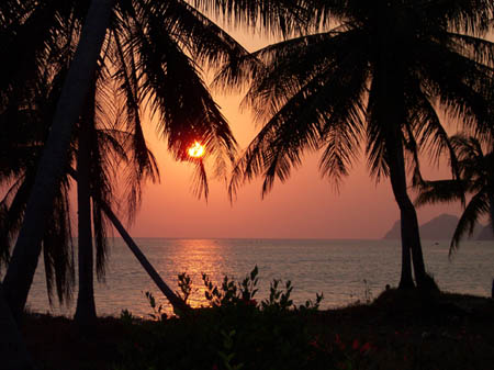
Here is a picture of the sunset in Thailand - beautiful! --- Copyright (c) Steven Robiner - All Rights Reserved - May Not Be Used Without Explicit Written Permission
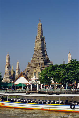
The city of Bangkok.
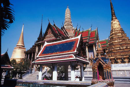
Another picture of downtown.
Thailand is located in Southeast Asia. It is about double the size of the state of Wyoming. I wonder if any of our blog readers live in Wyoming? We attached a Thailand map to show you where it is located.
Thailand has a pretty unique climate. The southern isthmus is always hot and humid. An isthmus is a narrow strip connecting two larger bodies of land. The rest of the country has changing weather based on the seasons. During the warm summer months of May through September, the weather is tropical, rainy, and warm. While in the cooler months (November - March), the weather is much dryer and cooler. The main natural hazard found in Thailand is drought. Over 27% of the land in Thailand is arable. Some of the agricultural products that come from Thailand include soybeans, coconuts, corn, sugarcane, rubber, rice, and cassava (aka - tapioca).
This country is rich in natural resources - rubber, tin, natural gas, fish, lead, timber, tantalum, tungsten, gypsum, fluorite, and of course, arable land. Thailand exports goods to many countries. Do you remember what it means when something is exported? Thailand exports rubber, jewelry, automobiles, computers, electrical appliances, textiles, footwear, fishery products, rice, and more. The country that receives the highest percentage of exported Thai goods is the USA! Holy Idaho! Over 15% of all of Thailand's exports are sent to the USA. Tourism is a major industry (as Vu knows). Other industries include jewelry, automobiles and automobile parts, computers, electrical appliances, and countless others.
Vu told us that Bangkok is the capital city of Thailand (Holy Idaho! How didn't we know that?) Thailand is divided into 76 provinces. A province is a name for a secondary - or smaller and less important level of government. A province is similar to a state (such as Arizona or Texas). And the BEST news of all, Bangkok is extremely close to the Gulf of Thailand - a beautiful beach area. It is only 2 pm, so guess where we are heading now? You guessed it - the beach.
- Meri
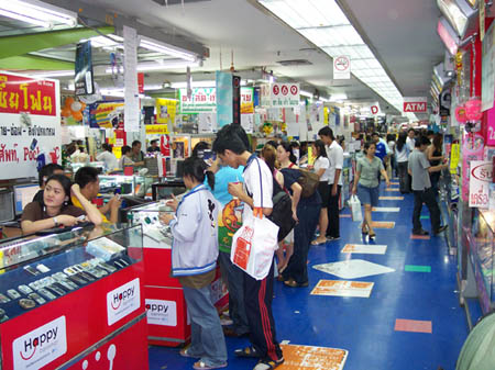
Shopping in Bangkok --- Copyright (c) Steven Robiner - All Rights Reserved - May Not Be Used Without Explicit Written Permission
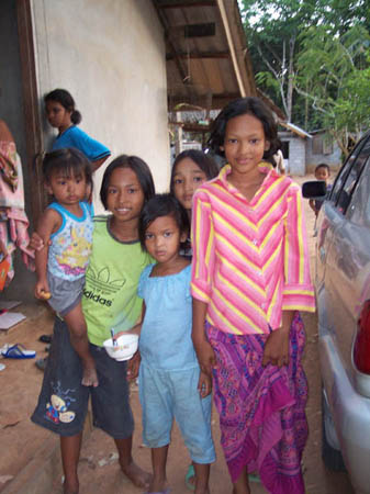
Vu's neighbors --- Copyright (c) Steven Robiner - All Rights Reserved - May Not Be Used Without Explicit Written Permission
Thailand Travel Guide
This website shows several pictures and videos of Thailand. Check them out!
Map of Thailand
Scroll down the map to view the various cities in Thailand. Can you find Bangkok? What other major cities are near Bangkok?
One day in Bangkok: 360° Virtual Tour with Voice Over
Do you want to see what Bangkok is like? Check out this cool video.
- Geo
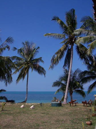
The BEACH --- Copyright (c) Steven Robiner - All Rights Reserved - May Not Be Used Without Explicit Written Permission
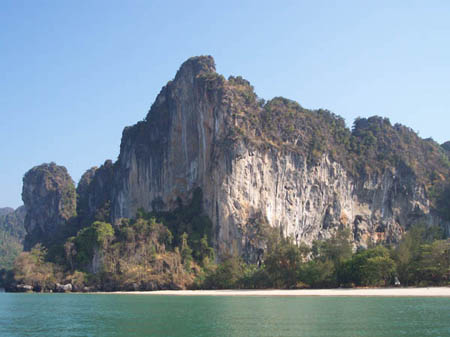
Look at this amazing view! --- Copyright (c) Steven Robiner - All Rights Reserved - May Not Be Used Without Explicit Written Permission
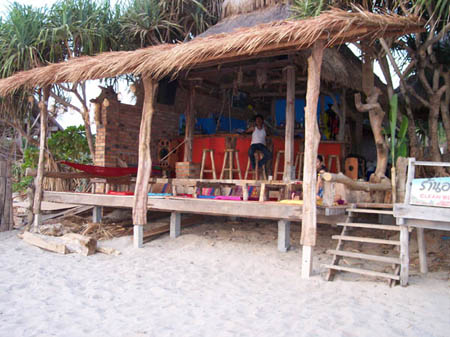
This is the beach restaurant where we ate dinner - we sat on cushions on the floor. It was so cool! --- Copyright (c) Steven Robiner - All Rights Reserved - May Not Be Used Without Explicit Written Permission
India is located in Southern Asia between Pakistan and Burma. It is bordered by the Arabian Sea and the Bay of Bengal. India is the 2nd most populated country in the world (China is the most populated). India is also the 7th largest country by geographical area. India is a Federal Republic with 28 states and 7 Union Territories. A Federal Republic is composed of self-governing states united by a federal government. The United States is also a Federal Republic. The overall size of India is about 1/3 of the size of the entire United States. The exact size of India is 3, 287,590 square kilometers.
The weather in India is temperate in the north and tropical in the south. Do you remember what parts of the U.S. are called "temperate?" India has several natural hazards like drought, earthquakes, severe thunderstorms, and even flash floods and monsoons. Some of the monsoons spread rain across a wide range of land and are highly destructive.
India has many natural resources, including limestone, petroleum, diamonds, chromite, natural gas, iron ore, mica, manganese, bauxite, titanium, ore, coal (4th largest amounts in the world), and lots of arable land. In fact, almost half (48%) of the land is arable. Some of the agricultural products that come from India include fish, sheep, goats, poultry, rice, wheat, cotton, oilseed, jute, tea, cattle, water buffalo, potatoes, and sugarcane.
We found some wonderful pictures of the country - check them out! We will write more tomorrow after our meeting about "the monkey."
- Geo
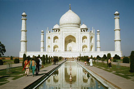
The Taj Mahal - an incredible monument finished around 1648. This world-famous monument is found in Agra, India.
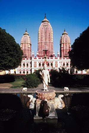
Here is the Laksminarain Temple - found in New Delhi, India.
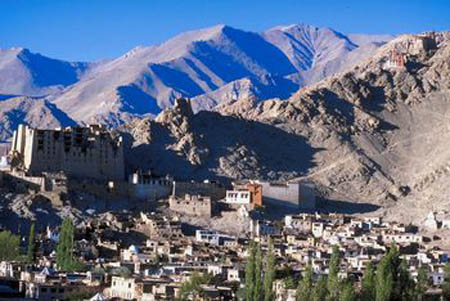
The mountainside of India.
Map of India
What countries surround India? What bodies or water border this country?
We ran (literally) back to our hotel room and called Uncle GT on the hotel phone. He told us that Mr. Win must have become suspicious of our "story." He said the blinking eye sounded like a nervous reflex because Mr. Win must have been worried about our visit or about our finding out the truth about something. Uncle GT told us to immediately go to the dumpster area of the company and FIND OUR PHONE!!! So we are now off to go through the trash - YUCK! We need your advice; we don't know where to begin. What do you think will help us find our phone the quickest?
- Meri
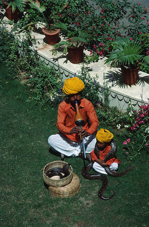
Here is a dad and child that we saw while we were out today. The dad seemed to be playing an instrument. Do you see those snakes? Yikes!
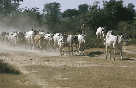
Here is a herd of oxen that we saw on our way to Veritas Resources.
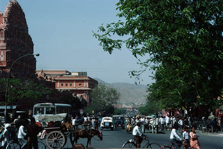
A beautiful picture of the city.
Map of India
Can you find New Delhi? What other countries are close? Can you find Nepal? Do you remember what famous \"mountain\" was in Nepal? Here is your clue - it is the highest elevation in the world!
arable - land that can be used to grow crops.
drought - a severe water shortage (very little rain).
earthquakes - shaking and vibration on the surface of the earth. Earthquakes can be a result of underground movement along a fault plane or from volcanic activity.
exported - when a crop (or another product) is sent or transported to another country (for money).
Federal Republic - self-governing states united by a federal government. The United States is an example of a Federal Republic.
isthmus - a narrow strip of land that connects two larger bodies of land.
monsoons - strong systems of wind, that usually bring in very heavy rains. They influence the climate of a large area.
natural hazard - extreme weather and/or other conditions caused by nature. Some examples include volcanoes, earthquakes, blizzards, tornadoes, droughts, tsunamis, and typhoons.
Natural hazards - extreme weather and/or other conditions caused by nature. Some examples include volcanoes, earthquakes, blizzards, tornadoes, droughts, tsunamis, and typhoons.
natural resources - any substance that is made by nature and used to enhance the lives of living things. Some examples of natural resources include sunlight, minerals, soil, and water.
provinces - a name for a secondary level of government (secondary to the country itself). A province is similar to a state (such as Arizona or Texas).
states - land areas that are under the jurisdiction of a government.
temperate - a climate that provides warm summers and mild winters. The temperatures do not typically get extremely hot or cold.
tropical - a climate with high temperatures and a decent amount of rainfall. Tropical climates are usually located between the Tropic of Cancer and the Tropic of Capricorn, closer to the equator than cooler, temperate climates.
Union Territories - a centrally administered subdivision of India. It is similar to a state or territory. India just calls them Union Territories.
Back to top
Grade 3-5: Knows the basic elements of maps and globes (title, legend, cardinal, scale, grid, meridians, time zones, etc.).
Grade 3-5: Knows major physical and human features of places as they are represented on maps and globes. Knows how to read different maps: road, relief, globe, etc..
Grade 3-5: Knows the approximate location of major continents, mountain ranges, and bodies of water on Earth.
Grade 6-8: Knows the location of physical and human features on maps and globes (e.g., culture hearths such as Mesopotamia, Huang Ho, the Yucatan Peninsula, the Nile Valley; major ocean currents; wind patterns; land forms; climate regions).
Grade 6-8: Knows the relative location of, size of, and distances between places.
Grade 3-5: Knows different methods to measure data (miles, kilometers, time, etc..).
Grade 6-8: Knows the human characteristics of places (e.g., cultural characteristics such as religion, language, politics, technology, family structure, gender; population characteristics; land uses; levels of development).
Grade 6-8: Knows the physical characteristics of places (soil, vegetation, wildlife, etc..).
Grade 3-5: Knows the characteristics of a variety of regions (climate, housing, religion, language, etc..).
Grade 6-8: Knows how places and regions serve as cultural symbols (Opera House in Sydney or Tower Bridge in London).
Grade 3-5: Knows the physical components of Earth's atmosphere (weather and climate), lithosphere (land forms such as mountains), hydrosphere (oceans, lakes and rivers), and biosphere (vegetation and biomes).
Grade 3-5: Knows significant historical achievements of various cultures of the world (e.g., the Hanging Gardens or Babylon, the Taj Mahal in India, pyramids in Egypt, temples in ancient Greece, bridges and aqueducts in ancient Rome).
Grade 3-5: Knows how and why people divide Earth's surface into political and/or economic units (e.g., states in the United States and Mexico; provinces in Canada; countries in North and South America; countries linked in cooperative relationships, such as the European Union).
Grade 6-8: Understands the symbolic importance of capital cities (such as Canberra, a planned city, as the capital of Australia).
Grade 3-5: Knows how humans adapt to variations in the physical environment (e.g. choices of clothing, housing styles, agricultural practices, recreational activities, food, daily and seasonal patterns of life).
Grade 3-5: Knows how communities benefit from the physical environment (e.g., people make their living by farming on fertile land, fishing in local water, working in mines; the community is a port located on a natural harbor, a tourist center located in a scenic or historic area, an industrial center with good access to natural resources).
Grade 3-5: Knows natural hazards that occur in the physical environment (floods, tornadoes, earthquakes, etc..).