Teacher Edition | View the Map
Week of February 26, 2023
Right click and SAVE AS
to download the Google Earth file for this episode
Use free Google Earth software
to OPEN it, using File> Open.
Find more tech info here.
We just got off the phone with Uncle GT. He told Geo that he wanted us to go look for that phone ASAP. Uncle GT is very familiar with how garbage chutes work. He said a dumpster should be somewhere on the same block as Veritas Resources. We are heading there now. We will update our blog once we find our phone. Holy Idaho! I hope we can find it!
- Meri
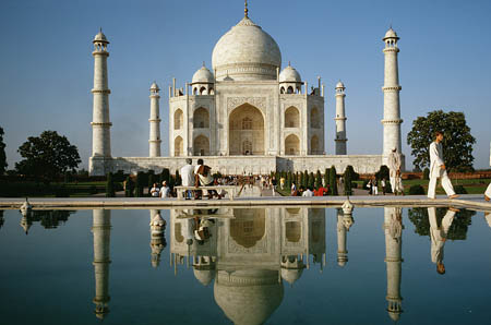
We finally got to visit the Taj Mahal today. It was even more beautiful in real life! Holy Idaho!!
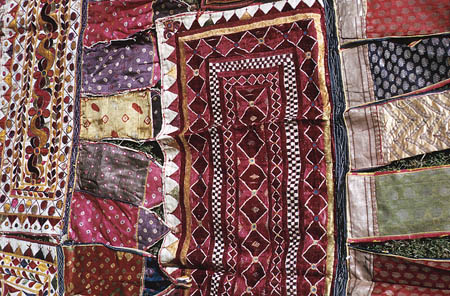
At the market today, we bought this quilt for our mom. We had to buy a box and take it to their local postal service to ship.
A to Z Kids Stuff - INDIA
Learn more about India through interesting facts and videos
We got to the first dumpster, which was only about half full (maybe even less). Meri and I put on our rubber gloves and climbed inside the dumpster. It gives me chills even thinking about it! There were only a few inches of trash in the dumpster; it took us less than 15 minutes to realize that we wouldn't find our phone in this mess. Since Meri had her own personal phone, she called the other phone's number and could not hear a ring. So, Meri and I left thinking that we had lost our phone. Then out of the corner of Meri's eye, she realized there was another dumpster about 50 feet away from us (but still close to the Veritas Resources building). So Meri and I quickly went to the second dumpster. We put our rubber gloves back on and headed inside this dumpster (which was nearly full). We searched through papers, bags, food, and others. We spent almost an hour digging through the trash. Meri tried to call the other phone again, and it went right to voicemail. Finally, we found a phone. When I say "we," that is the truth. Meri and I each found a phone at the exact same moment. What are the odds of finding two different phones that were IDENTICAL (the same make and model) inside of the trash at the EXACT same time? We tried to turn on both phones. Both phones were damp and appeared to have dead batteries. We decided to take both phones to the hotel and put them on our chargers. Hopefully, one of these two phones was our phone from GT for this mission. We also found a HUGE clue. We need your help to try to figure out what it means. We found a crumpled-up piece of paper (ripped in half). We could only make out part of the information. The only statements we could make were Place: Turkme---, Training: German Shep ---, Mission: Nrthwst Pa ---. Can you look at the attached map and see if we are anywhere near any countries (or cities) that start with Turkme---? We know that Dewey is mainly a German Shepherd (mixed with some other breed). I bet I know what the "Mission" is. Do you?
- Geo
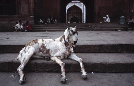
Look what we saw near the dumpster!
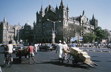
This is the street where the dumpster was located. I get chills thinking about it - yuck!
South Asia Map
Click to open up the map. Can you find the country that begins with Turkme --? What is the country\'s full name? Are we close to the country? What cardinal direction will we be traveling from New Delhi to the mystery of Turkme-?
Meri has been reading about Turkmenistan and found some fascinating facts. Did you know that Turkmenistan is rich in natural resources, especially natural gas, sulfur, gas, and petroleum? Some of the exported goods from Turkmenistan include crude oil, gas, and textiles. Most of the country's exports (47%) go to Ukraine. Sometimes I wonder why every country's export partners are different. Do you think it has something to do with where they are and what other countries need? The main religion of Turkmenistan is Muslim (90% of citizens are Muslim). The official language is called "Turkmen." I have never heard of that language, have you? Okay, our taxi has arrived at the airport we will update our blog after we check in with the airline.
- Geo
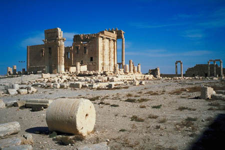
The desert area of Turkmenistan
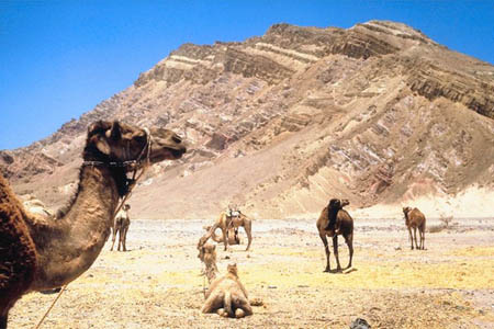
Another picture of Turkmenistan
- Meri
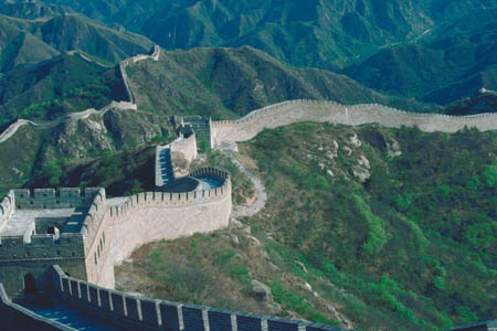
This is a picture of the Great Wall of China! Holy Idaho!
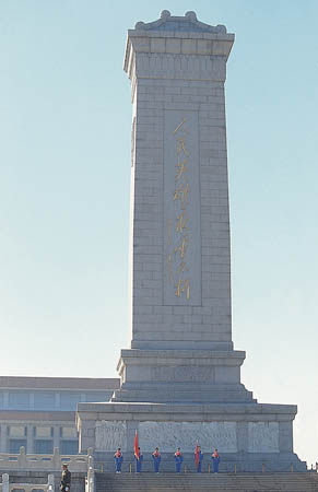
Here is another famous tourist attraction - Mao Tse-tung. I wonder how you pronounce that?
cardinal direction - a term used to describe all four primary directions (north, south, east and west).
exported - when a crop (or another product) is sent or transported to another country (for money).
Middle East - a region of countries that are considered to be the gateway from Asia to the east and Europe.
Middle Eastern - a region (of countries) considered to be the gateway from Asia to the east and Europe.
natural resources - any substance that is made by nature and used to enhance the lives of living things. Some examples of natural resources include sunlight, minerals, soil, and water.
Back to top
Grade 3-5: Knows the basic elements of maps and globes (title, legend, cardinal, scale, grid, meridians, time zones, etc.).
Grade 3-5: Knows major physical and human features of places as they are represented on maps and globes. Knows how to read different maps: road, relief, globe, etc..
Grade 3-5: Knows the approximate location of major continents, mountain ranges, and bodies of water on Earth.
Grade 6-8: Knows the location of physical and human features on maps and globes (e.g., culture hearths such as Mesopotamia, Huang Ho, the Yucatan Peninsula, the Nile Valley; major ocean currents; wind patterns; land forms; climate regions).
Grade 6-8: Knows the relative location of, size of, and distances between places.
Grade 6-8: Knows the human characteristics of places (e.g., cultural characteristics such as religion, language, politics, technology, family structure, gender; population characteristics; land uses; levels of development).
Grade 6-8: Knows the physical characteristics of places (soil, vegetation, wildlife, etc..).
Grade 3-5: Knows the characteristics of a variety of regions (climate, housing, religion, language, etc..).
Grade 3-5: Knows significant historical achievements of various cultures of the world (e.g., the Hanging Gardens or Babylon, the Taj Mahal in India, pyramids in Egypt, temples in ancient Greece, bridges and aqueducts in ancient Rome).
Grade 3-5: Knows how and why people divide Earth's surface into political and/or economic units (e.g., states in the United States and Mexico; provinces in Canada; countries in North and South America; countries linked in cooperative relationships, such as the European Union).
Grade 6-8: Understands the symbolic importance of capital cities (such as Canberra, a planned city, as the capital of Australia).