Teacher Edition | View the Map
Week of March 5, 2023
Right click and SAVE AS
to download the Google Earth file for this episode
Use free Google Earth software
to OPEN it, using File> Open.
Find more tech info here.
China is one of the world's oldest civilizations. It has the world's longest-used written language. We have some pictures in our blog showing the Chinese written language. Thankfully, Chinese is one of the two languages that Geo has learned during school! So he can understand the street signs and some of the phrases we have heard. Geo has been reading about China all morning (he is SO excited to be here). He just told me four HUGE inventions were invented in China - paper, gunpowder, the compass, and printing. They also invented the wheelbarrow. Holy Idaho! I wonder what type of printing? Do you think they mean books, or newspapers, or something different? Also, did you know that "China" includes more than just the mainland of China? I bet you did know that. Remember we visited one of the Special Administrative Regions (SARS) of China - Hong Kong. We also learned about the other SAR (Macau). The Chinese government also says it controls Taiwan, but the people of Taiwan have formed a separate government. It all sounds very complicated.
The climate of China is extremely diverse, like the U.S. The extreme south is mainly tropical. The winters are mild, and the summers are very hot. The central part of China has a temperate climate. Do you remember what temperate means? The northern part of the country (where Beijing is located) is subarctic. A subarctic climate has comfortable summer months (never too hot) and extremely frigid winters. They are so cold that the encyclopedia said the winter in Beijing is of "Arctic severity." I guess that means VERY COLD!! Holy Idaho! This country has some wild natural hazards. The country averages five typhoons per year. Do you remember what a typhoon is? The country also has earthquakes, tsunamis, damaging floods, droughts, and land subsidence. Do you know what land subsidence means? I didn't, so I asked Geo to look it up. He explained that a land subsidence occurs because of the lowering of a portion of the Earth's crust. When the waters get lower, new land areas appear. So, I guess China has some "new" land areas because of the surrounding seas losing water and becoming shallower. Whew - that is a little confusing! I guess it's kind of like land shifting and reshaping itself.
Most of China's arable land is near the country's two largest rivers (Huang He and Yangtze). About 15% of China's land is arable. I bet you remember what arable means - right? Some products grown on the arable land of China include rice (I knew that), corn, potatoes, wheat, peanuts, tea, barley, apples, cotton, oilseed, millet, and many other agricultural products. China has many rivers, most of which flow into the Pacific Ocean. This country has a ton of different types of landforms. They have mountains, deserts, hills, high plateaus, plains, deltas, and more! It might be fun to look at and compare the landforms in China with the ones back in the U.S.
China has numerous natural resources. In fact, they have the world's largest hydropower potential. Do you think the United States uses hydropower at all? China also has tungsten, zinc, uranium, lead, aluminum, coal, iron ore, petroleum, natural gas, mercury, tin, antimony, manganese, molybdenum, vanadium, and magnetite. Holy Idaho! China is RICH in natural resources. Geo says they are buying up a lot of oil from the Middle East though, because they don't produce as much as they need. I'll have to look up where the Middle East is again.
We are unpacking right now. Then we plan to grab some breakfast on our way to Veritas Resources . Thankfully, we know it is on Wusi (near Jinghsan Park). We will update our blog when we return.
- Meri
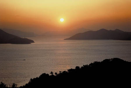
This picture shows the East China Sea. Isn't it amazing!
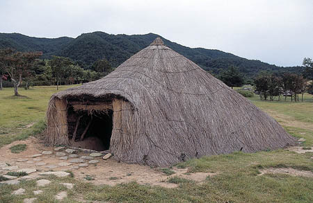
Here is a picture of a hut found in China. We didn't actually see any of these around Beijing. Can you imagine living in that house? Holy Idaho!
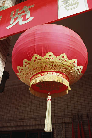
This is a decorative hanging lantern. It is across the street from the hotel.
While we were walking today, we saw a lot of signs about the 2008 Summer Olympics AND the 2022 Winter Olympics. Did you know they were both held in Beijing? I wish we had been here during the Olympics. Those were the only two times the Olympics were held in China.
Today we went to see the Great Wall of China (we attached some new pictures). Some beautiful parts of the wall north of Beijing are tourist attractions nowadays. The Great Wall of China is over 4,000 miles long. That is longer than if you drove from New York to California (the entire width of the United States). That is one LONG wall. In fact, it is the longest man-made structure in the world. The wall crosses rivers, goes across deserts, and even goes up over mountains. It was built over 2,000 years ago! The wall is made of rocks, masonry, and packed earth. See the links attached to this blog entry for more information about this incredible structure.
- Geo
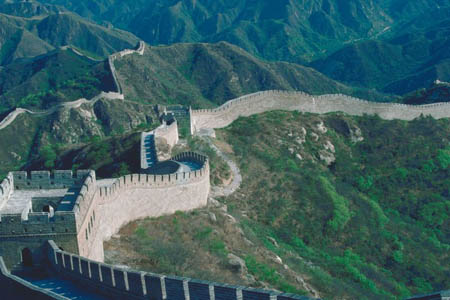
Here is the picture of the Great Wall of China that we saw online.
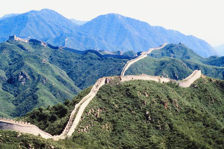
Another picture we found of the Great Wall of China.
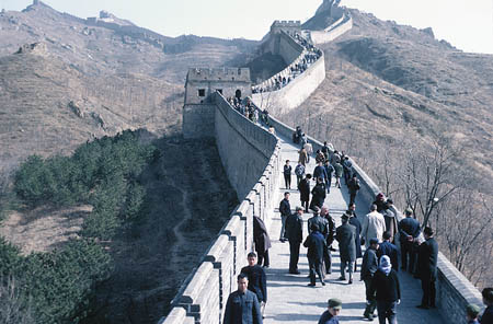
The Great Wall of China - amazing!!
Great Wall of China
Take a virtual tour of the Great Wall of China.
Travel for Kids
This website provides information about the Great Wall of China, books about the Great Wall of China, lots of pictures, and more.
Beijing 2022 Winter Olympics
By visiting this website, you can learn more about the 2022 Olympics (and the various sports).
Text Message to Pandora: Holy Idaho! We are gr8! In China
Holy Idaho! I am so glad our phone is working. We still lost our contacts, but we restored almost everything else on our phones.
Holy Idaho! You won't believe what just happened. Geo just heard the OTHER phone beep - we got a text message in Chinese. I am so glad we kept the extra phone! It must be our lucky day since Geo knows a lot of Chinese from taking a few years of Chinese in school. The message translated to the following,
German shepherd training has been moved to Moscow, starting next Monday. Dogs will be shipped over the weekend. Please follow the confidentiality code. More information to follow.
WHAT!!!! We immediately called Uncle GT and told him about the odd text message. He had us end our phone call on our cell phone and try to call him back on the "extra" cell phone. So, we did what Uncle GT asked. Uncle GT has a detailed caller identification system through the U.S. government. So, when we called him - he realized that our "extra" phone belonged to Veritas Resources. We were so confused. Why would we have found a phone from the company in the garbage? There are so many unanswered questions. But one thing is certain - Uncle GT wants us to head to Moscow, Russia. Uncle GT is pretty sure that Dewey would be one of the dogs being moved to the Moscow headquarters. Holy Idaho! I wonder if the company realized we were in China. Uncle GT booked us on a flight to Moscow for Sunday night. At least we have two more days to explore China. Uncle GT told us exactly where the company headquarters is located in Moscow. So since we have 2-days left in China, where do you think we should explore next? See the attached link and help us decide where we should explore. We have chosen our "top 3" destinations - The Forbidden City, Li River, and Yellow Mountain. We will only have time to travel to one location; which should we choose?
- Meri
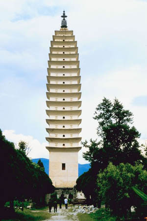
This picture shows a Buddhist Temple in China. Buddhism is one of the religions that some Chinese practice.
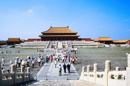
The Forbidden City
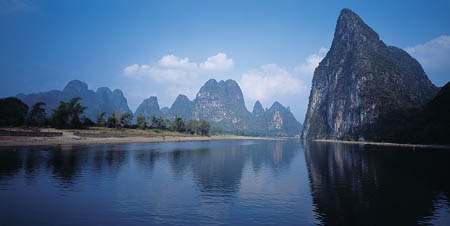
Li River - isn't it beautiful!
China Travel Tour Guide
Look at this website, and read about the Li River, the Forbidden City, and Yellow Mountain. Which one do you think we should visit tomorrow?
arable - land that can be used to grow crops.
deltas - the triangular piece of land (usually sand and soil) that is located at the mouth (or inlet) of a river where it meets salt water.
droughts - severe water shortages (very little rain).
earthquakes - shaking and vibration on the surface of the earth. Earthquakes can be a result of underground movement along a fault plane or from volcanic activity.
land subsidence - occurs because of the lowering of a portion of the Earth's crust. When the waters get lower, new land areas appear. It is kind of like land shifting and reshaping itself.
Middle East - a region of countries that are considered to be the gateway from Asia to the east and Europe.
Natural hazards - extreme weather and/or other conditions caused by nature. Some examples include volcanoes, earthquakes, blizzards, tornadoes, droughts, tsunamis, and typhoons.
natural resources - any substance that is made by nature and used to enhance the lives of living things. Some examples of natural resources include sunlight, minerals, soil, and water.
Special Administrative Regions - a region that has their own government, but they are still under the overall jurisdiction of a country. This is very similar to a state or territory.
Subarctic - a climate with comfortable summer months (never too hot), and extremely frigid winters.
temperate - a climate that provides warm summers and mild winters. The temperatures do not typically get extremely hot or cold.
tropical - a climate with high temperatures and a decent amount of rainfall. Tropical climates are usually located between the Tropic of Cancer and the Tropic of Capricorn, closer to the equator than cooler, temperate climates.
tsunamis - an enormous ocean wave that is produced by a landslide, volcanic eruption, or a sub-marine earthquake.
typhoon - a large and powerful tropical cycle with extreme winds. They typically occur in areas around the Western Pacific Ocean or the Indian Ocean.
typhoons - large and powerful tropical cycles with extreme winds. They typically occur in areas around the Western Pacific Ocean or the Indian Ocean.
Back to top
Grade 3-5: Knows the basic elements of maps and globes (title, legend, cardinal, scale, grid, meridians, time zones, etc.).
Grade 3-5: Knows major physical and human features of places as they are represented on maps and globes. Knows how to read different maps: road, relief, globe, etc..
Grade 3-5: Knows the approximate location of major continents, mountain ranges, and bodies of water on Earth.
Grade 6-8: Knows the location of physical and human features on maps and globes (e.g., culture hearths such as Mesopotamia, Huang Ho, the Yucatan Peninsula, the Nile Valley; major ocean currents; wind patterns; land forms; climate regions).
Grade 3-5: Knows different methods to measure data (miles, kilometers, time, etc..).
Grade 6-8: Knows the human characteristics of places (e.g., cultural characteristics such as religion, language, politics, technology, family structure, gender; population characteristics; land uses; levels of development).
Grade 6-8: Knows the physical characteristics of places (soil, vegetation, wildlife, etc..).
Grade 3-5: Knows the characteristics of a variety of regions (climate, housing, religion, language, etc..).
Grade 6-8: Understands criteria that give a region identity (such as Amsterdam as a transportation center or the Sunbelt's warm climate and popularity with retired people).
Grade 6-8: Knows how places and regions serve as cultural symbols (Opera House in Sydney or Tower Bridge in London).
Grade 3-5: Knows the physical components of Earth's atmosphere (weather and climate), lithosphere (land forms such as mountains), hydrosphere (oceans, lakes and rivers), and biosphere (vegetation and biomes).
Grade 3-5: Knows significant historical achievements of various cultures of the world (e.g., the Hanging Gardens or Babylon, the Taj Mahal in India, pyramids in Egypt, temples in ancient Greece, bridges and aqueducts in ancient Rome).
Grade 6-8: Knows the consequences of a specific physical process operating on Earth's surface (e.g., effects of an extreme weather phenomenon such as a hurricane's impact on a coastal ecosystem, effects of heavy rainfall on hill slopes, effects of the continued movement of Earth's tectonic plates).
Grade 3-5: Knows the similarities and differences in characteristics of culture in different regions (in terms of food, shelter, social organization and others).
Grade 6-8: Understands the symbolic importance of capital cities (such as Canberra, a planned city, as the capital of Australia).
Grade 3-5: Knows natural hazards that occur in the physical environment (floods, tornadoes, earthquakes, etc..).
Grade 6-8: Knows how the physical environment affects life in different regions (e.g., how people in Siberia, Alaska, and other high-latitude places deal with the characteristics of tundra environments; limitations to coastline settlements as a result of tidal, storm, and erosional processes).