Teacher Edition | View the Map
Week of March 12, 2023
Right click and SAVE AS
to download the Google Earth file for this episode
Use free Google Earth software
to OPEN it, using File> Open.
Find more tech info here.
Here are some interesting facts that we have learned. Russia is located in Northern Asia and Eastern Europe. There is no easy "dividing line" that separates the continent of Asia from Europe (like a body of water). Many people consider the Ural Mountains to be the "border." With that description, Moscow is technically located in Europe. Meri and I are still in Asia, but Uncle GT did say we were heading to Europe soon. Then, we would have been to 6 of the 7 continents. We have included some links to more information about Russia. We still haven't heard anything from Uncle GT. I wonder what time it is in Washington, D.C.? It looks like China is 13 hours ahead of Washington, D.C. I wonder if Uncle GT is asleep?
- Geo
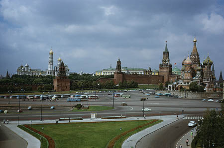
A photo we found of the city of Moscow
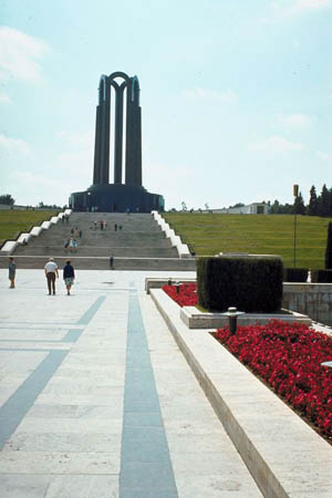
A World War II Monument that is in Moscow.
Virtual Tour of Moscow\'s Red Square! (at Christmas) | 360° Video
Check out this video of Moscow, so cool. It was taken last Christmas - but it show you a lot of the sites of this cool city.
Airpano
Take a look at the virtual tour of Moscow.
Geo wanted to do some research about Europe. As usual, he taught me a lot of cool information. Europe is part of the landmass referred to as Eurasia. Do you remember what areas Eurasia encompasses? On the eastern side of the continent, Europe is landlocked. The continent is bordered by the Arctic Ocean to the north, the Atlantic Ocean to the west, and the Mediterranean Sea to the south. Europe is the second smallest continent in the world. I wonder what the smallest continent is. I don't think we have been to the smallest continent. We have heard people at our hotel talking about Eastern Europe and Western Europe. Geo explained that most of Eastern Europe used to be part of the Soviet Union. The Soviet Union was formed in 1922. Originally there were only four countries in the Soviet Union, but this increased to fifteen countries by the time the Soviet Union went through dissolution in 1991. The word dissolution means to "dissolve" or "disappear." I guess each country in the union decided to have its own independent government, so the Soviet Union ended. Many of the countries that were a part of the former Soviet Union are now countries in Europe. Geo says it was complicated ---sort of the way China and Taiwan are.
Europe has some really cool landforms and countries. Europe has many mountain ranges. Some of the longest include the Scandinavian Mountains (at 1095 miles), the Carpathian Mountains (at 900 miles), the Alps (at 750 miles), the Caucasus Mountains (at 683 miles), and the Apennine Mountains (at 620 miles). I have heard of the Alps before. Have you ever heard of these mountain ranges? Europe also has many famous rivers. Some of the larger rivers include the Seine, Volga River, Ural River, and Rhine River. Most of the rivers empty into the Black Sea, Caspian Sea, or Baltic Sea.
Europe is an amazing continent with impressive historical achievements, beautiful monuments, and breathtaking landscaping. Holy Idaho! I hope we get to see this fascinating continent in person! Take a look at this colorful map that we found.
- Meri
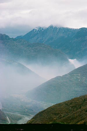
The Alps! Holy Idaho - they look amazing!
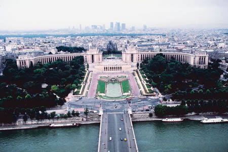
The Seine River, with a view of Paris.
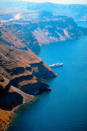
The beautiful Mediterranean Sea!
Interactive Map of Europe
Do you see the large gray country on the eastern side of the map? That is Russia. (Of course, it does not have a straight line dividing it the way the map looks!) Can you locate the Atlantic Ocean? The Mediterranean Sea? What other European countries can you find?
- Geo
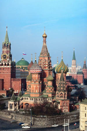
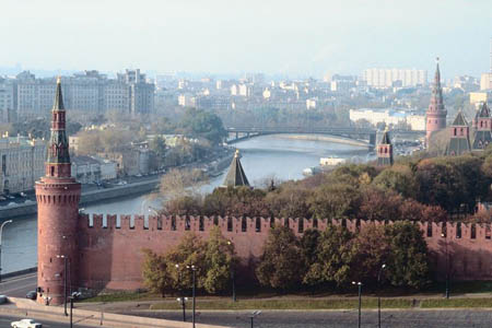
This picture shows the Kremlin. This is a famous building in Moscow.
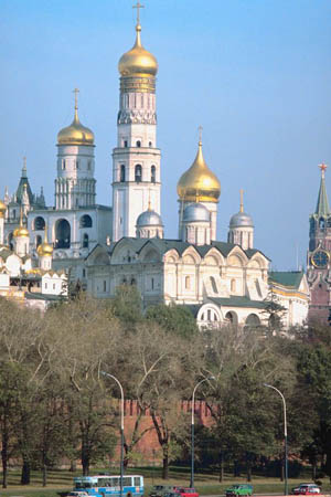
The Kremlin - did you know that the president of Russia resides in the Kremlin?
Mr. Chun walked us quickly to the animal shelter area. It was amazing --- no cages or anything. Each animal had a soft chair, carpeted floor, and friendly humans playing with them. Dewey's "room" was the last one on the right side of the shelter area. We arrived there, but his room was empty! Mr. Chun was extremely upset and thought we planned this "disappearance." We explained to him that we knew nothing. We called Uncle GT on the speaker phone from Mr. Chun's office. Uncle GT calmed Mr. Chun down and asked him to check the surveillance cameras. We checked the security video from the previous 2 hours (thankfully, one camera displayed the entire hallway of the animal shelter). You won't believe what we saw. About 5 minutes after we arrived to see Mr. Chun, an unidentified woman was seen walking down to Dewey's room. She was wearing a long fur coat with a hood. We weren't able to make out her face. She put a leash around Dewey's neck and sneaked him out the back door. We asked Mr. Chun to zoom in on the woman's face. Unfortunately, her face was too blurry to identify. We called Uncle GT again, and it turns out he is flying to Europe tomorrow morning for business. We are meeting him with the security video. His office in Europe has the capability to use enhancement software technology to analyze the surveillance video. Hopefully, they can clearly understand WHO the woman is and why she took Dewey. We will update our blog when we know where we are heading next.
- Meri
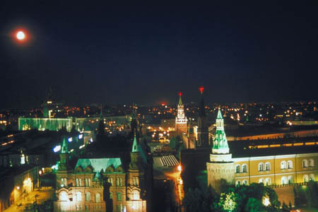
The night view of Moscow (a picture we found)
Another beautiful picture of Moscow (a picture we found)
- Geo
Map of Scandinavia
Which country is located at 62 00 North and 15 00 East? Remember to click on the map to make the map larger (and easier to read).
dissolution - to dissolve or disappear.
Eurasia - the giant land mass that encompasses parts of Europe and Asia.
landlocked - an area that is surrounded on all sides by land, no water.
latitude - the lines that run across (east and west) a map. Lines of latitude measure degrees via north or south. The equator is at 0 degrees latitude.
longitude - lines that run up and down the map (north and south). These lines are used to measure degrees east or west from the prime meridian. The prime meridian is located at 0 degrees longitude.
map coordinates - numbers that provide the exact location of a specified country or other area. The coordinates provide the degrees of longitude and latitude. Coordinates help people locate specific areas on a map.
Back to top
Grade 3-5: Knows the basic elements of maps and globes (title, legend, cardinal, scale, grid, meridians, time zones, etc.).
Grade 3-5: Uses map grids (e.g., latitude and longitude or alphanumeric system) to plot absolute location.
Grade 3-5: Knows major physical and human features of places as they are represented on maps and globes. Knows how to read different maps: road, relief, globe, etc..
Grade 3-5: Knows the approximate location of major continents, mountain ranges, and bodies of water on Earth.
Grade 6-8: Knows the location of physical and human features on maps and globes (e.g., culture hearths such as Mesopotamia, Huang Ho, the Yucatan Peninsula, the Nile Valley; major ocean currents; wind patterns; land forms; climate regions).
Grade 6-8: Knows the human characteristics of places (e.g., cultural characteristics such as religion, language, politics, technology, family structure, gender; population characteristics; land uses; levels of development).
Grade 6-8: Understands criteria that give a region identity (such as Amsterdam as a transportation center or the Sunbelt's warm climate and popularity with retired people).
Grade 6-8: Knows how places and regions serve as cultural symbols (Opera House in Sydney or Tower Bridge in London).
Grade 3-5: Knows the physical components of Earth's atmosphere (weather and climate), lithosphere (land forms such as mountains), hydrosphere (oceans, lakes and rivers), and biosphere (vegetation and biomes).
Grade 3-5: Knows significant historical achievements of various cultures of the world (e.g., the Hanging Gardens or Babylon, the Taj Mahal in India, pyramids in Egypt, temples in ancient Greece, bridges and aqueducts in ancient Rome).
Grade 3-5: Knows how and why people divide Earth's surface into political and/or economic units (e.g., states in the United States and Mexico; provinces in Canada; countries in North and South America; countries linked in cooperative relationships, such as the European Union).
Grade 6-8: Understands the symbolic importance of capital cities (such as Canberra, a planned city, as the capital of Australia).