Week of November 24, 2024 | View the Map
Right click and SAVE AS
to download the Google Earth file for this episode
Use free Google Earth software
to OPEN it, using File> Open.
Find more tech info here.
Monday
When we landed in Colombia, we had another mysterious text message.
The text message from the unknown caller: We R - 34 S, 64 W
We called Uncle GT immediately, and he said that the text message sounded like map coordinates that measure the exact location of an area on a map. I wonder where the captors are telling us to go? The 34 S represents the line of latitude, and the 64 W represents the line of longitude. Now we have to go back to our map and see if we can figure out what country Dewey is actually in. We are spending the night at the airport hotel in Colombia, so we can figure out where we are to go next. Uncle GT sent us a few links to help us better understand reading map coordinates. I hope these can help us figure out where to go next. Reading map coordinates is similar to reading coordinates in math class (if you have learned about the coordinate plane in math class); check out some of these simple activities and get ready to help us figure out our next destination.
- Geo
Map of South America
Can you figure out the large bodies of water that border South America?
Latitude and Longitude
Share this engaging video to learn more about latitude, longitude, and reading maps!
Tuesday
So our mysterious location must be between those two lines of latitude. Which countries are between the 20 S and 40 S locations? Since the exact location is 34 S, the country must be closer to the 40 S line of latitude. Geo and I have narrowed down our possibilities to Chile, Argentina, or Uruguay. Now let's look at the lines of longitude. The text message said 64 W. This means that the location is 64 degrees west of the prime meridian. That was the line way across the Atlantic in Greenwich, England. The lines of longitude were sometimes difficult to see. Geo and I noticed three lines of longitude included on this map (80 W, 60 W, and 40 W). The country we are looking for is close to 60 W, since the exact location is 64 W. Remember, we had three possible countries (Chile, Argentina, or Uruguay). Are any of these countries near the 60 W line of longitude? Check out the map and see if you can figure out where we are heading tomorrow morning. Holy Idaho - we really need your help!
- Meri
Map of South America
Take a look at the map and see if you can figure out where 34 S, 64 W is located?
Tuesday Night
During our flight, Meri sat next to a teenage girl from Argentina named Nora. Nora told us all about her home country of Argentina. The capital is Buenos Aires, which is the city we are flying into tonight. And similar to Brazil, Argentina is located in the southern hemisphere. Nora is on her summer break right now. (Remember, the southern hemisphere has summer during the months of December, January, and February). The official language of Argentina is Spanish. And over 90% of people in Argentina are Roman Catholic. There are 23 provinces in Argentina (pronounced provincias in Spanish). Provinces are similar to states (such as New York or Idaho). A province is a name for a secondary level of government (a smaller section of a larger country). Nora told us that her favorite hobby is to ski. We were surprised to learn that Argentina gets cold enough in the winter for skiing. Argentina actually has some of the tallest mountains in the world (the southern Andes). I was also shocked to find out Argentina experiences earthquakes, violent windstorms (in the Pampas), and extremely heavy flooding. I keep trying to think of places in the U.S. with similar landforms and climates. I also wonder what the Pampas are. Take a look at the map of Argentina. Can you find the Pampas? We are landing now. Tomorrow Nora is going to take us on a tour of Argentina.
- Geo
Map of Argentina
Take a look at the map of Argentina. Can you find the Pampas?
Wednesday
After learning about the Pampas, we headed west towards the Andes. Nora took us on a day tour that flew us southwest from Buenos Aires to the rugged Andes of western Argentina. It was a beautiful flight, and then we took a vigorous hike to the top of a mountain. When we finally reached the top, we realized the other side of this mountain was a cliff! Holy Idaho! I was ready to turn around and head back down the way we climbed up. But Geo noticed a strange brown envelope about 8 feet down on the cliff. There was part of one word visible on the envelope - DEW..., then something we couldn't quite see because the envelope was folded over. Can you believe it? We weren't sure how Claude and Phoebe Equator knew we were going to be at that cliff. We can't tell Nora about our top-secret mission. How can we get that envelope? How can we keep Nora from knowing too much? What should we do? We could use the rope in our backpacks to rig up a harness. Geo said he was willing to go down the 8-foot cliff; Nora and I would secure the rope for him. OR, do you think we should call Uncle GT and follow his instructions? OR should we just give up on the envelope and hike back down the mountain? We really need to know what is in that envelope. It could be the key to solving this mysterious case.
- Meri

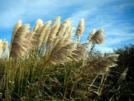
The Pampas (up close)

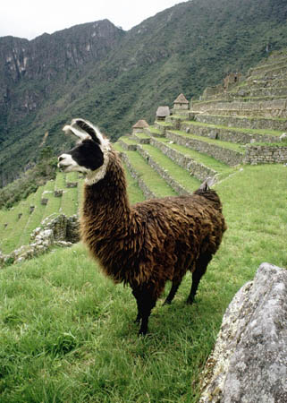
It is a llama!
Vote Here:
Links to learn more :
World Atlas - Columbia
Visit this website to learn more about Colombia.
17