Week of January 12, 2025 | View the Map
Right click and SAVE AS
to download the Google Earth file for this episode
Use free Google Earth software
to OPEN it, using File> Open.
Find more tech info here.
Friday
Oceania is made up of many islands and countries, which can be confusing. It is divided into four regions, each containing numerous countries and islands. The regions include Australasia, Polynesia, Micronesia, and Melanesia. We attached a map that shows Oceania@.
The first region (Australasia) includes Australia, New Zealand, and a few smaller islands belonging to Australia. The largest island/country in Oceania is Australia. In fact, the total land area of Oceania is approximately 9,008,000 square kilometers. Australia accounts for 7,600,000 of those square kilometers. So, as you can see, over 75% of Oceania is Australia. Australia is surrounded by both the Indian and Pacific Oceans. Australia is the sixth-largest country in the world. Geography is fascinating.
The region of Polynesia includes numerous island nations; however, many are claimed or are territories of other countries nearby or from around the world, such as New Zealand, France, the United States, or the United Kingdom. Samoa, Tonga, and Tuvalu are all located in Oceania and are all actually independent nations.
The region of Micronesia consists of the Federated States of Micronesia, Guam (a United States territory), Kiribati, Marshall Islands, Nauru, Northern Mariana Islands (another United States territory), and Palau.
The region of Melanesia includes East Timor, Fiji, Papua New Guinea, Solomon Islands, and Vanuatu. New Caledonia is also a country of Melanesia but France's territory. Indonesia is also partly in Micronesia. This is the most fascinating country of all, in my opinion. Indonesia has 17,508 islands (although humans only live on about 6,000 of them).
Okay, our airplane is getting ready to land in Wellington, New Zealand (the capital city). We will write more once we get some rest. I am glad we have a few days to relax before the conference.
- Geo
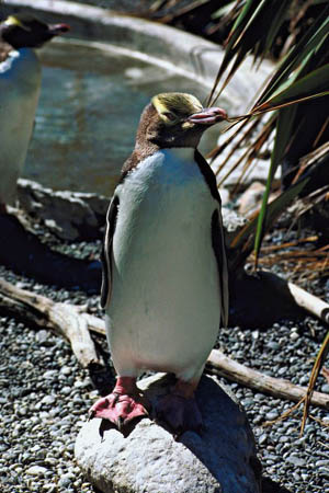
This is a picture of the yellow-eyed penguin (found in New Zealand).
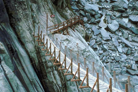
This is a picture of a really cool bridge in New Zealand - isn't it neat! Would you walk across that bridge?
Map of Oceania
Check out this map of Oceania. All of the countries in Oceania are written in RED.
Oceania Explained
Do you want to learn more about Oceania? This video does a great job explaining all of those many islands.
Sunday
Text Message from Pandora - How R U? RUOK? No news from U? Call or text ASAP. BBFN.
Text Message to Pandora - We R N BTFL N. Zealand. Will Call U 2MORO.
In other news - NEW ZEALAND ROCKS! New Zealand is located in the South Pacific Ocean and is Southwest of Australia. New Zealand is about the same size as the state of Colorado (the home of Denver, The Mile High City). There are many natural resources found in New Zealand: natural gas, iron ore, sand, gold, coal, timber, limestone, and hydropower. Earthquakes are very common in New Zealand but are rarely severe. This country also has numerous volcanoes. Do you suppose earthquakes and volcanoes are related? New Zealand has three national languages (English, Maori, and sign language). I wonder why one country would have three national languages. About 80% of New Zealanders live in major cities. I guess this is because work is easier to find in the cities. Can you think of other reasons why New Zealanders (sometimes known as "kiwis" - not to be confused with kiwifruit!) might live mostly in cities? Most of the major cities are located on New Zealand's coast, making it easier to ship items. Tourism is a major industry in New Zealand, and a reasonable number of New Zealand residents work in the tourism industry. We will update our blog tomorrow - after our encounter with the Equators. Wish us luck!
- Meri
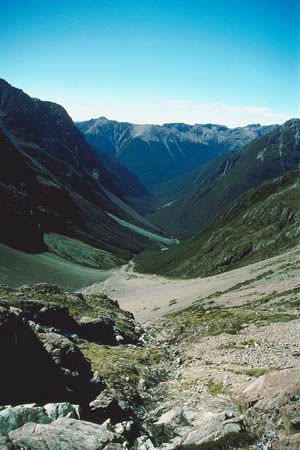
Check out the amazing landscape of New Zealand!
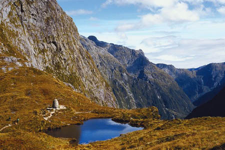
Look at this beautiful pond in the mountains of New Zealand. Wow!
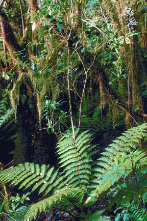
Here is a beautiful picture of a rainforest in New Zealand.
Airpano
This site takes you on a 360-degree virtual tour of New Zealand.
Check out the Botanic Gardens
Check out this amazing place that we saw over the weekend!
What is the Northwest Passage?
Learn more about the Northwest Passage with this up to date site.
Monday
- Meri

Here are the Equators! Can you believe it - we took a screenshot of them during the conference before they went to talk.
Vote Here:
Links to learn more :
Kiwi Conservation Club
This website provides information about the unique wildlife of New Zealand.
39