Week of February 5, 2023 | View the Map
Right click and SAVE AS
to download the Google Earth file for this episode
Use free Google Earth software
to OPEN it, using File> Open.
Find more tech info here.
Friday Night
We are currently 21st in line for take-off! Holy Idaho! How long will that take? At least it gives us more time to stay connected to our data plan and research Asia. Asia is a fascinating and HUMONGOUS continent. In fact, Asia is the largest continent in the world - but it is also the most populated continent in the world! Holy Idaho! I wonder how many people live in Asian countries. Geo researched and found out more information. First, the overall size of the continent equals about 30% of the land area of the entire world. Holy Idaho! Can you believe that? Second, the population is more than four billion people. Over 60% of the entire world's population lives in Asia. Wow, I thought that the United States had a lot of people! The total population of the United States is about 332 million. Holy Idaho! We don't even have nearly half as many people in the USA as in Asia.
We have attached a map of Asia, so you can see exactly where we are going. This continent is located mainly in the northern hemisphere and eastern hemisphere. But since it is so huge, there are also small parts of Asia in the southern hemisphere and western hemisphere. Do you remember what a hemisphere is? Hemisphere means half of a sphere. The northern hemisphere and southern hemisphere are divided by the equator (land and water north of the equator is in the northern hemisphere, and any land or water south of the equator is in the southern hemisphere). The eastern hemisphere and western hemisphere are divided by the prime meridian (the imaginary line that runs up and down a map or globe). All land and water east of the prime meridian is in the eastern hemisphere. While land and water west of the prime meridian is in the western hemisphere.
Asia is often referred to as a part of Eurasia (the giant land mass that encompasses Europe and Asia). Asia occupies much of Eurasia, while the western side of the land mass is the continent of Europe. Off of the eastern coast of Asia is the International Dateline. This is kind of confusing. The International Dateline is an imaginary line of longitude (our map shows it) on the surface of the Earth. It is on the opposite side of the world than the Prime Meridian. Here is the confusing part - when someone crosses this imaginary line, it results in a day or 24 hours being added or subtracted. If you head east leaving Asia and fly over the International Dateline, you subtract 24 hours. So if it was 6 pm on Friday night and we flew over the International Dateline heading east, it would now be 6 pm on Thursday night! Holy Idaho - isn't that wild? And then the opposite reaction happens when you fly west over the International Dateline you add 24 hours. So instead of being 6 pm on Friday night, it is now 6 pm on Saturday night - that means a day actually "disappears" out of my life --- or I get to live the same day twice! I will go speak to one of the airline employees and see when we will take off - it has been over 2-hours now.
- Meri
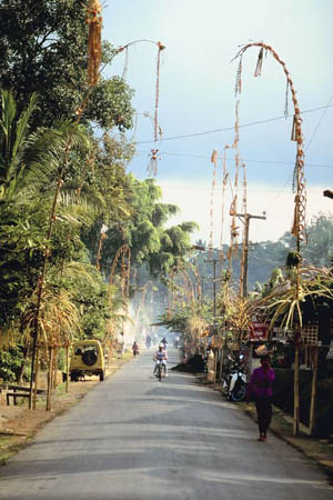
This picture shows one of the beautiful towns in Indonesia.
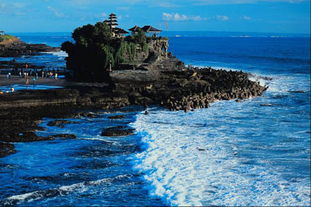
Here is a picture of Bali - a tropical tourist location in Indonesia. I dream of going to Bali!!
Map of Asia
Take a look at the attached map to see the amazing continent of Asia (the grey areas represent Asia). Can you find Russia? Japan? China? Pakistan? Korea? Indonesia? Can you find the International Dateline?
Time Zone Converter
Here is a link to a time zone converter. Check it out. Try the time zone converter to see different times RIGHT NOW in Indonesia, Russia, Japan, China, and where you live.
Friday Night (later)
Text Message From Pandora - wayn? ru2ok?
Text Message To Pandora - On plane
Text Message From Pandora - 2 where?
Text Message to Pandora - Will call 2nite
Text Message From Pandora - 2 where?
Text Message to Pandora - Can't cuz secret. bbfn
- Geo
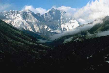
Mt. Everest - WOW!!
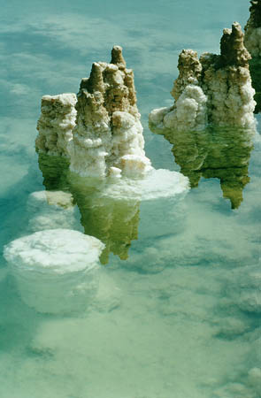
The Dead Sea (the white formations are salt and mineral deposits)
Airpano
Take a virtual tour of Mount Everest. Holy Idaho - so cool!!
Map of Asia
Can you locate the country we are flying to? OR WAITING to fly to? What other countries will we be near?
Saturday
The weather here is very hot and humid since we are so close to the equator. The map coordinates for Indonesia are 5 00 South and 120 00 East. Since 0 degrees latitude represents the equator and Indonesia is at 5 00 South, we are VERY close to the equator - and boy, can we feel the heat! Indonesia experiences many natural hazards including earthquakes, volcanoes (Indonesia is also near the Ring of Fire), occasional floods, forest fires, severe droughts, and even tsunamis!
Indonesia is blessed with many natural resources, including tin, petroleum, natural gas, timber, nickel, copper, coal, silver, gold, fertile soils, and more. Over 11% of the land here is arable. Do you remember what arable means? Some of the leading agricultural products include rice, eggs, pork, beef, poultry, palm oil, copra, coffee, cocoa, rubber, and peanuts, among others.
The people in Indonesia work in various industries, including tourism, food, plywood, chemical fertilizers, petroleum, natural gasses, rubber, footwear, and many others. I would like to know if any of my shoes were made in Indonesia. The main exports of Indonesia include electrical appliances, oil and gas, textiles, rubber, and plywood. They are exported to countries all over the world, including Japan, China, and even the United States! Do you remember what the term exported means?
Geo and I are heading out "on the town" now. Veritas Resources is closed until Monday. So we will post again after we visit the company.
- Meri

Here is a picture of the busy city.
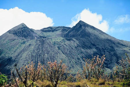
Mount Bator - a popular volcano (and tourist attraction) in Indonesia
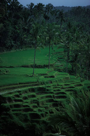
Rice paddies I saw in Indonesia
VISITING THE MONAS TOWER JAKARTA: Indonesia landmark (vlog)
This is a really cool video about Jakarta and the Monas Tower. Take a look and you will feel like you are there yourself!
Monday
- Geo
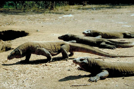
Here is a picture we found of varanus komodensis (AKA - komodo dragons). Yikes, glad we didn't see any upclose!
Map of Asia
Can you look at the attached map and tell us what cardinal direction we will be traveling to go from Indonesia to Hong Kong?
Vote Here:
51