
Week of November 5, 2023 | Week 3 Map
Right click and SAVE AS
to download the Google Earth file for this episode
Use free Google Earth software
to OPEN it, using File> Open.
Find more tech info here.
Hey, this is Pandora. You know, I was reading the choices about Utqiagvik, Alaska. A friend of mine asked me if you knew about a disaster that took place in Valdez, Alaska? I know this is hundreds of miles from Utqiagvik, but my friend thought that Utqiagvik was involved somehow? She knew that her parents had mentioned it, but neither of us knows much about it. Do either of you? Why didn't you use that as one of your choices last week? That would have been much cooler!
Pandora - I can answer your friend's question for you tomorrow, I promise. I did attach some pictures that might interest you (of the disaster). Holy Idaho! You should see them!!
- Meri
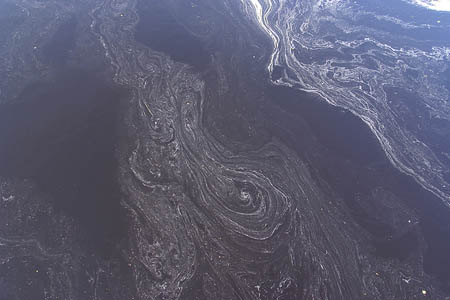
A picture of an oil spill from the air.
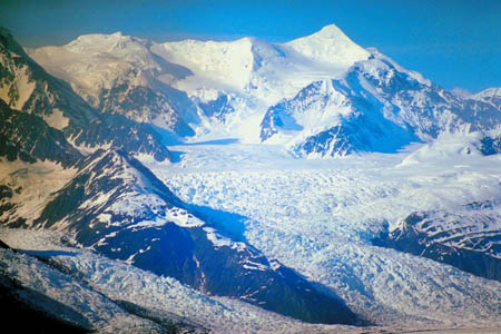
The beauty of Alaska
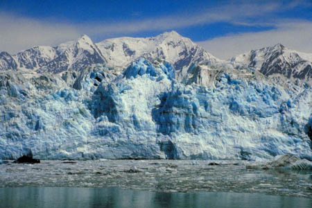
Another beautiful picture
Monday
March 24, 1989, is when the famous Valdez oil spill occurred. The spill occurred hundreds of miles away from Utqiagvik, (in Valdez, the southern end of the TransAlaska oil pipeline). The spill is still considered one of the worst human-caused disasters ever to happen at sea, even 30 years later. This oil spill wasn't one of the largest oil spills in the world, but it did cause a great deal of damage and death to the wildlife surrounding the Prince William Sound. Many of the local islands are only accessible by boat or airplane, so it was hard to clean up the oil spill. Over 10 million gallons of oil were spilled into the sea! I wonder how much 10 million gallons would be. That sounds like a LOT of oil! This area was a habitat for seals, seabirds, salmon, sea otters, and many other forms of wildlife. Clean up was slow; many wildlife animals died in the water, and it was just a sad event in United States history.
The Trans-Alaska pipeline runs from Prudhoe Bay down to Prince William Sound. (See the link below to see pictures and videos of the Trans-Alaska Pipeline.) It was built in the 1970s. It completely changed the economy of Alaska forever. Thousands of people moved to Alaska to help build it --- and never left. I wonder how long it took to build the pipeline?
Last weekend we traveled to Utqiagvik, Alaska, the furthest northern part of the entire United States. Great job to those students who guessed that answer last week! Louie was here making a speaking engagement to workers here about renewable resources and energy. I wonder why he would come to Utqiagvik to discuss this topic. This small town does not look like it has much, but it does have its own small airport! This airport is the only year-round access to Utqiagvik, the economic center of Alaska's North Slope.
Did you know that Utqiagvik is in both a desert and a tundra? As a desert, Utqiagvik averages less than 5 inches of rain each year. This includes the 30 inches of snow each year (since one inch of rain is approximately equal to twelve inches of snow). A tundra is a treeless area with very little vegetation and nearly completely frozen ground. They have a very hard time putting up buildings on that tundra, and they all look kind of funny up on stilts. They call the frozen ground permafrost. Permafrost is ground that is permanently frozen.
Utqiagvik is classified as being in a polar climate. It is cold and dry. Utqiagvik is about 320 miles north of the Arctic Circle! That is VERY far north. We attached a map for you to see. The Arctic Ocean surrounds Utqiagvik on three sides. Utqiagvik has the lowest average temperatures in Alaska. They even have days of "white out" conditions from the blowing snow. Do you know why people call them "white out" days? The summer is also cool (even on the warmest day). Temperatures are below freezing from October through May! There are some snowy days from June through September. Wow - that is COLD. And let me tell you, we can feel the cold. Meri and I both have to borrow "winter gear" any time we go outside (full body snowsuits, gloves, hats, and completely covered faces). I have to admit I am excited. We don't see much snow in Phoenix. I guess this climate is a lot different than Phoenix, even though they are both deserts. How does your own city's climate compare to Utqiagvik?
Here is something I bet many of you don't know - Utqiagvik is one of the cloudiest places on Earth, mainly because of the prevailing easterly winds from the Arctic Ocean. Another fascinating fact is that Utqiagvik is only accessible by plane. I am not sure why, but no roads seem to lead to Utqiagvik? Utqiagvik appears to be a peninsula. A peninsula is land that is surrounded by water on all but one side. If land is entirely surrounded by water, it is called an island. The Utqiagvik residents actually drive small four-wheel drive vehicles. I am glad that I already did Drivers's Education and have my license. Speaking of Utqiagvik residents, did you know that Utqiagvik has been the home to the Inupiat Eskimos for over 1,000 years? They use the name Ukpeagvik or "place where snowy owls are hunted". Do you remember what Utqiagvik used to be called? If you guessed Barrow, you are geography geniuses!
- Geo
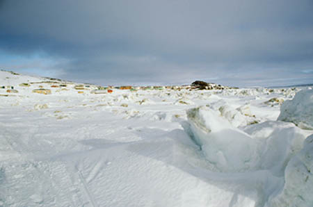
Daytime view (which we don't see often)
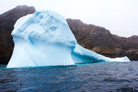
Beautiful ice formation
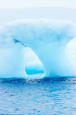
Ice formation - WOW
Map of Alaska
Can you find Utqiagvik? What other cities/towns can you locate? Why do you think so many have names that sound like a different language?
Trans-Alaska Pipeline
View this video to learn more information about the Trans-Alaska Pipeline.
Wednesday
Well, yesterday was the meeting where Louie was speaking. The community center wouldn't allow Geo and me inside, since we didn't have tickets to attend. It was already getting dark when the convention began. There isn't much daylight time in this part of Alaska during this month of the year because of the earth's tilt. The sun doesn't even rise between mid-November and late January each year!). So, we waited in the entrance area. We figured that we couldn't miss him there; plus, this option was INSIDE, where it wasn't the Arctic Tundra or DARK. So, we waited and waited... and waited! Well, people started coming out about 2 hours later. We split up and asked if anyone knew where he was. Since he was the main speaker, all of the attendees knew who we were talking about. The second person we spoke with apologized and explained that Louie had left about 30 minutes before the end of the meeting. He had gone out of the room through the back, and they assumed he might have used the back door! Holy Idaho! Why doesn't this man want us to find him? Do you think he is hiding a secret? Why do you think he sneaked out the back door?
- Meri
Animals of Alaska
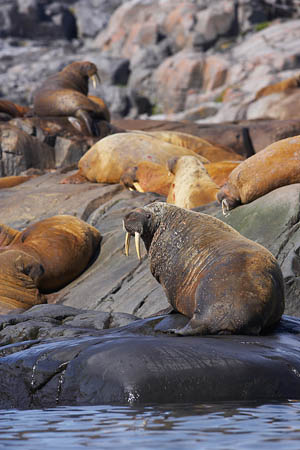
More Alaskan wildlife
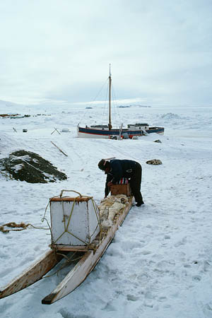
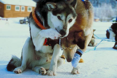
Isn't this a neat form of transportation?
Vote Here:
89
Copyright © 2011-2024 by The Source for Learning, Inc. All rights reserved.