
Week of December 10, 2023 | View The Map
Right click and SAVE AS
to download the Google Earth file for this episode
Use free Google Earth software
to OPEN it, using File> Open.
Find more tech info here.
Friday
Holy Idaho! Only one more day until our cruise! This morning we went to check out a cool manmade canal outside of Chicago. We actually took a day trip to the village of Sheffield, Illinois. It was so much fun. We attached a link to learn more about the Hennepin Canal. Here are some of the fascinating facts we learned on our quick trip. Construction on this canal was begun in 1892. The first boat went through in 1907. How many years did it take for the construction?
The Hennepin Canal reduced the distance from Chicago to Rock Island by 419 miles. That would be saving about 7 hours if driving on a highway. What a useful canal. Do you know what a canal is? A canal is an artificial waterway that is created for travel, shipping, or other reasons. Canals often connect places, such as two bodies of water or other transportation systems like roads or railroads. This canal (and its sister canal, the I & M Canal) connected the Illinois, Des Plaines, and Mississippi river systems with the Gulf of Mexico. I bet both of these canals helped Chicago to become the big and bustling city that it is today. The Hennepin Canal remained open to boat traffic until 1951. The Hennepin Canal has 33 locks on it; 32 are still visible today! I wonder why we don't use canals as much anymore? Although this canal had limited success as a waterway, the ideas used for this canal were also used to build the HUGE Panama Canal. Have you ever heard of that? Both used concrete lock chambers, to "lock" the water into certain compartments so boats can move up or down in elevation. We attached a neat video of the Panama Canal also. The video really helps to explain the lock system.
The Hennepin Canal reduced the distance from Chicago to Rock Island by 419 miles. That would be saving about 7 hours if driving on a highway. What a useful canal. Do you know what a canal is? A canal is an artificial waterway that is created for travel, shipping, or other reasons. Canals often connect places, such as two bodies of water or other transportation systems like roads or railroads. This canal (and its sister canal, the I & M Canal) connected the Illinois, Des Plaines, and Mississippi river systems with the Gulf of Mexico. I bet both of these canals helped Chicago to become the big and bustling city that it is today. The Hennepin Canal remained open to boat traffic until 1951. The Hennepin Canal has 33 locks on it; 32 are still visible today! I wonder why we don't use canals as much anymore? Although this canal had limited success as a waterway, the ideas used for this canal were also used to build the HUGE Panama Canal. Have you ever heard of that? Both used concrete lock chambers, to "lock" the water into certain compartments so boats can move up or down in elevation. We attached a neat video of the Panama Canal also. The video really helps to explain the lock system.
- Meri
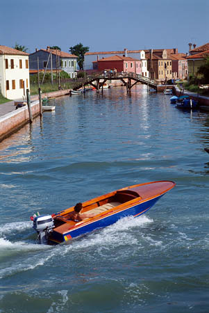
Picture of a canal
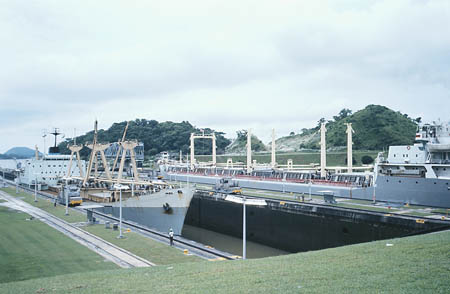
Panama Canal
Panama Canal
Learn about the lock system used at the Panama Canal.
Saturday
Well, the big day is finally here! We boarded our cruise about an hour ago. We said bye to Uncle GT at the port and headed on our journey. Once we were in our room, we called the front desk to ask if we could be connected to Louie's room. They said no, that unless we had a room number, they could not connect us because of privacy laws. We texted GT to try to find out his stateroom number. We are going to explore the ship and try to figure out where he could be. There is a room with an interactive map showing where we travel, our speed, etc. We are going to start there since we KNOW he loves maps. I bet we will be spending a lot of time there during our trip.
- Geo
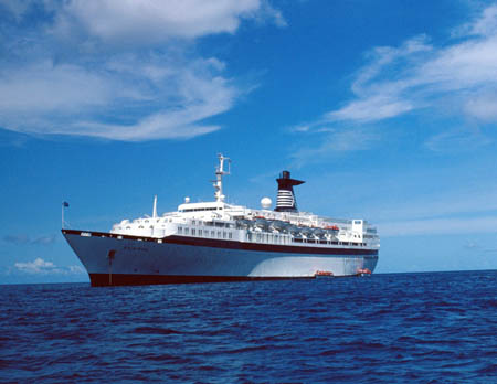
Our River cruise ship! The water was blue (in Chicago), but quickly changed to a brownish shade as we traveled.
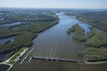
The Mississippi River from the top deck (see the river water is brown)
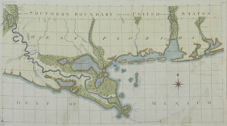
A picture of an old map that we found! I bet Louie would love this map! What location do you think this map represents?
Sunday
Well, after one day aboard this beautiful ship we have seen no signs of Louie. We sat in the "map room" for over 3 hours straight yesterday. We also included a map in our blog.
GT just sent us a text confirming that Louie's credit card was never reimbursed, so Louie must be on the ship somewhere. GT couldn't find out the specific stateroom number.
We are a few days away from Helena, Arkansas. Have you ever heard of Helena? It is a Mississippi river town. We did some research to learn more about it. Helena is actually called Helena-West Helena (a combination of two cities from 2006). This port town dates back to the 1810s, when steamboats began to travel on the Mississippi River. How many years ago was that? Back then a lot of goods were transferred, bought, and sold right along the river. Of course, that was before larger ships, trains, trucks, airplanes, and other ways to transport goods.
Helena was even an important city during the Civil War. Do you know anything about that war? Helena was occupied by the Union Army and the site of the "Battle of Helena."
This Mississippi River town grew into a blues music community during the 1940s and 1950s. The city continued to grow rapidly until the 1970s. There was a large company (Mohawk Rubber Company) that closed in the 1970s, and a lot of the residents lost their jobs. Why do towns depend on businesses to grow? There are now about 15,000 people who call Helena-West Helena home. Considering Phoenix is the home to about 1,567,000 people, Helena-West Helena is a lot smaller. But then again, Phoenix is one big and busy city! I can't wait to see Helena-West Helena!
- Geo
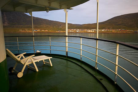
A sitting area outside of our cabin

Here is picture of a blues sign from Helena (we found it on a postcard). It must have been outside a club, How cool!
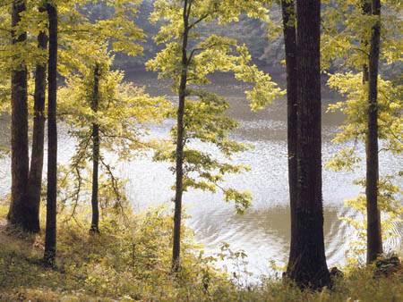
Sailing along the Mississippi!
Map of states along the Mississippi River
Tuesday
Tomorrow we disembark (get off) the ship, and we STILL haven't seen or heard from Louie. This is getting so frustrating. Holy Idaho! We just had a knock on the door and Geo ran to see who was visiting. Instead of a person, there was a sign hanging on our door with handwriting on it.
The sign said
"6pm at the River Lounge - L"
Holy Idaho! It must be L for Louie. It is 4:30 right now, so we have over an hour to wait! I wonder how we can convince Louie to come back to Washington, D.C.? And I wonder how he found out our room number, when we could never find him? Do you think he was wearing a disguise of some sort?
- Meri
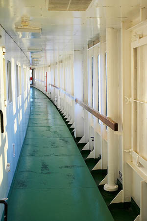
On our way to the River Lounge
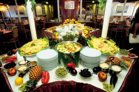
Check out the yummy buffet at the River Lounge!
Tuesday Night
We arrived at the River Lounge at 5:45 and sat right inside the door. Louie wasn't there yet. We waited and ordered our sodas and dinner. We waited, and waited, and waited! When our waiter brought out our cabin slips to sign (to bill our food), there was no slip in the leather holder. Instead of a slip, there was another note from Louie.
Hey Guys. I am sorry to stand you up. I do not want to work with the government right now. I have my own projects back home. I am heading to one of my vacation homes to investigate what I have learned during my travels during the past several weeks. I can't wait to see the Palm Trees and the beauty of Kilauea.
We figured with that name it had to be somewhere in Hawaii. Be sure to check out the map of Hawaii we shared here. I wonder which island has Kilauea? I guess we will be traveling VERY FAR west to the beautiful Pacific Ocean and Hawaii. Do you remember what an island is? An island is land surrounded by water on all sides. Hawaii has several islands: Hawaii (the Big Island), Kauai, Oahu, Molokai, Lanai, and Maui. We did some research and found out that Kilauea (which is a LIVE volcano!) is NOT on Lanai, Molokai, or Kauai. Can you check out the islands and figure out which is home to this famous volcano and probably to Louie's vacation house?
- Geo
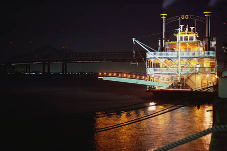
Look at this neat river boat we saw tonight!
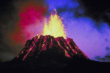
Here is a picture we found of Kilauea
Kilauea Video
This short video takes you right to this active volcano. I can\'t wait to get there!
Map of Hawaii
Here is a map of Hawaii. Can you find Kilauea? Which island is this ACTIVE volcano located on?
Vote Here:
97
Copyright © 2011-2024 by The Source for Learning, Inc. All rights reserved.