
Week of December 31, 2023 | View the Map
Right click and SAVE AS
to download the Google Earth file for this episode
Use free Google Earth software
to OPEN it, using File> Open.
Find more tech info here.
Sunday
- Meri
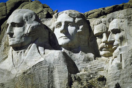
Do you know what this is a picture of?
Monday
Do you want to know something wild? Over 90% of Mount Rushmore was carved using dynamite. In fact, dynamite removed about 450,000 tons of rock from the mountain. Wow, I would have liked to see that! The entire memorial has an elevation of 5,725 feet. Do you remember what elevation means? The memorial covers over 1,200 acres. Wow, this thing is going to be huge.
The Sculptor, Gutzon Borglum (plus 400 workers), began drilling into the 5,724-foot mountain in 1927. He was 60 years old. The project took over 14 years to complete and cost the United States a mere $1,000,000. I am sure in the 1930s and 1940s, that was a lot more expensive than a million-dollar project would be in the 21st century, since a dollar is worth less and less every year. I wonder what that would be equivalent to in the 2020s?
Mount Rushmore represents the first 150 years of United States history. Borglum chose these four presidents because of their role in expanding US territory and preserving the Republic. Do you know what a republic is? OK, our plane is about to land in South Dakota. We have attached a map of the United States. Can you find South Dakota? Is this state located in the northern (top), southern (bottom), or middle part of the United States?
- Geo
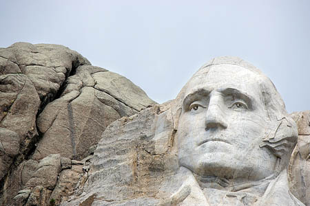
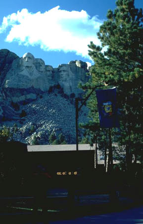
Another picture of Mount Rushmore. Do you know the face on the mountain?
Another picture we found of Mount Rushmore
Map of USA
Can you find South Dakota? Is it in the northern or southern part of the United States?
Tuesday
Txt from GT: L just put $ on Visa for prking @ Mt. Rmore
Holy Idaho! If he parked, he must be visiting Mount Rushmore today. We are going to head out as soon as possible. Geo just called for a cab.
Email from Pandora:
I was reading your blog about the construction of Mount Rushmore. Considering dynamite was used, were there many people who were hurt or lives lost? Did anybody fall? Sounds kind of scary!
Email to Pandora:
Although working with dynamite can never be entirely safe, no lives were lost at all throughout the 14 years of construction of the monument.
We have seen so many fascinating animals here in South Dakota: birds (bald eagles, hawks, turkey vultures, and more), mammals (badgers, coyotes, bobcats, raccoons, and even bighorn sheep), and others. Although this area does receive about 18 inches of rain each year, it isn't enough to support all of the plants and animals. That doesn't seem like much water at all. Many dams (and seeps and springs) help to provide watering spots for the animals.
The weather in Mount Rushmore is fascinating. Spring and fall are both pretty short seasons. May and June are the wettest months of the year (glad we aren't visiting then). During summer months, thunderstorms are common for a few hours in the afternoon. They are caused by orographic lift. Orographic lift refers to when elevated terrain, such as mountains, acts as a barrier to the flow of air. When the air ascends (or goes up) a mountain slope it gets cooler. When it cools, that causes clouds and precipitation. At the same time warm air is rising from the plains. When the cold air and warm air meet, the atmosphere becomes unstable and thunderstorms occur. We included a link to learn more about the orographic lift. Most of the weather during the summer is pleasant. We are here during winter, and it isn't nearly as cold as we thought. There is some snow on the ground, but only a small dusting. It is much colder in other cities we have visited.
- Meri
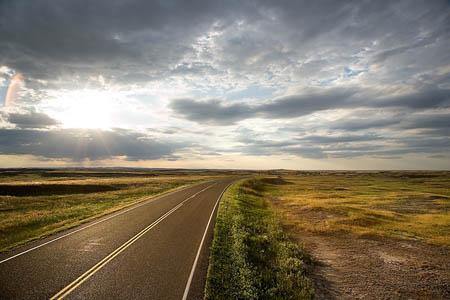
The beautiful land of South Dakota
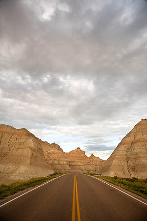
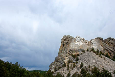
Look at the mountains of South Dakota!
Orographic Lift
Learn more about orographic lifts at this website.
Tuesday Night
Txt from Louie:
Leaders have vision. C U @highest pt of App Mtns for a better vu
Well now Meri and I are frustrated and confused. Vision? We just saw an amazing sculpture of some great leaders, but does Louie mean a real view or a different kind of "vision"? The App. Mtns? What could that mean? I think it must be some large mountain range? Is it near Mt Rushmore? App could stand for Application, but that makes no sense. I have heard of the Appalachian Mountains, have you heard of those? I have also heard of people walking on the Appalachian Trail (which stretches across the Appalachian Mountains). We learned about that in geography class. I remember it stretches about 2,000 miles! And the trail goes through 14 states. It was also America's first national scenic trail. I have no idea where the mountains and trail are located, though. According to my computer, they are in the eastern portion of the United States. Which cardinal direction will we be traveling from South Dakota to the Appalachian Mountains (use the map in the attached link)? Can you figure out where the highest point of the Appalachian Mountains is? You may need to do a little research!
- Geo
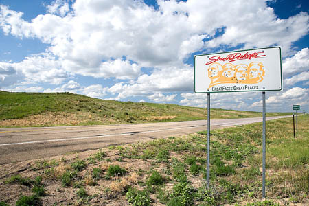
Here is a sign that we saw on our way to Mount Rushmore
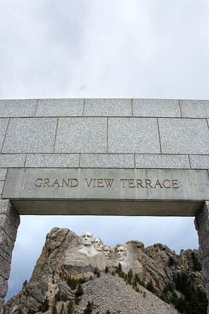
Mount Rushmore
A great picture Meri took at Mount Rushmore
Physical Map of the United States
Can you find South Dakota on this map? Look for the Appalachian Mountains, what cardinal direction will we be traveling now?
Mount Rushmore
Learn more about Mount Rushmore at this interactive site!
Vote Here:
100