
Week of January 7, 2024 | View the Map
Right click and SAVE AS
to download the Google Earth file for this episode
Use free Google Earth software
to OPEN it, using File> Open.
Find more tech info here.
Saturday
We wanted to update our blog quickly. We traveled from South Dakota to North Carolina yesterday. Tomorrow we are heading out to the Appalachian Trail. I can't believe how long the trail stretches! According to my research, it is 2,175 miles long. Holy Idaho! I am glad we aren't hiking the entire length. I have heard of people that do hike the entire Appalachian Trail. They call them "through-hikers." The Appalachian Mountains (and trail) are located in the eastern half of the United States. They stretch through 14 states: Maine, New Hampshire, Vermont, Massachusetts, Connecticut, New York, New Jersey, Pennsylvania, Maryland, West Virginia, Virginia, Tennessee, Georgia, and North Carolina. 541 miles of the 2,175 are all in Virginia, while only 2 miles are in West Virginia!
We are currently staying in North Carolina because that is the home of the HIGHEST peak of the Appalachian trail (well, sort of). We are very close to the Tennessee border because according to our research, the highest peak on the Appalachian Trail is Clingman's Dome. It is also the highest peak in the Smoky Mountains! That seems to match the clues. I hope Louie is there or at least left us a clue! Today it is POURING rain and very cold, so we can't go hiking until tomorrow. Tomorrow is actually supposed to be sunny.
Typical weather here on the border of North Carolina and Tennessee is mild in the summer and harsh (cold) in the winter. It is comparable to the climate in southeastern Canada. Holy Idaho, I thought North Carolina would be warmer. I guess it is because we are up in the mountains and at a higher elevation. This area also gets heavy snow during the winter months. There is some snow on the ground now, but just leftover snow from a storm a few days ago.
- Meri
The highest peak of the Appalachian Mountains is also near us in North Carolina: Mount Mitchell.
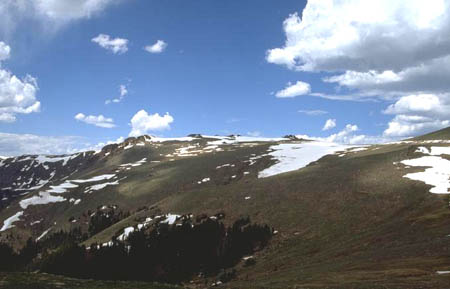
Snow covered mountains of North Carolina
Sunday
Meri and I had lots of time to research this fascinating area and learned a lot. Because this area has very high elevations, the plant life is exposed to extremely high levels of pollution including acid precipitation in the form of snow, rain (like yesterday), and even fog. This pollution can damage the spruce and fir trees which are common in this area. The pollutants are often carried in from great distances (for example, the Midwest). The pollution can come from local places or from hundreds of miles away. Isn't that fascinating! I wonder if that is why Louie is here. He seems to really care about air pollution and other environmental concerns.
Well, we are off to hike on the Appalachian Trail, looking for Louie. We will update our blog when we return. We attached a map, check it out.
Well, we are off to hike on the Appalachian Trail, looking for Louie. We will update our blog when we return. We attached a map, check it out.
- Geo
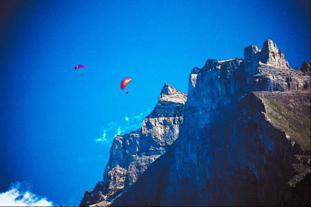
Appalachian Mountains
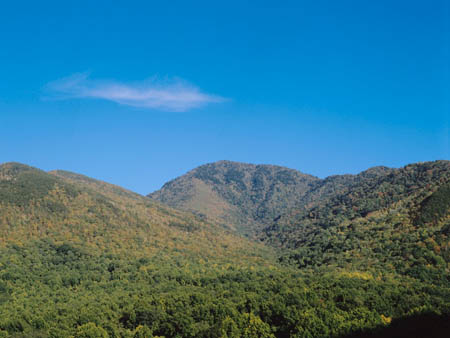
Another picture of North Carolina
Physical Map of the United States
Check out this map of the USA. What other mountain ranges can you find? The Appalachian Mountains run through many states, can you see them on the map? What other features are shown on a physical map, that might not be seen on a political map? Do you know the difference?
Monday
Holy Idaho! I don't know where to begin describing our adventurous day! I don't have long to write, so I will type as quickly as possible (using my smartphone before the helicopter ride makes us lose our signal! Remember where we are, in case you don't hear from us.)
First of all, Clingman's Dome is amazing. It is one of the most beautiful places we have been so far (check out our pictures). We wore very warm clothes like the ones we wore in Alaska because the winds and low temperatures made it QUITE cold!
About an hour after we started our hiking, we ran into another hiker who looked like he needed our help. He had been hiking for a few days and somehow had lost his cell phone. He was carrying just the bare minimum of clothing and food (because everything was on his back). So we offered him our cell phone to call his family and let them know that he was alright and was just a few days away from home. Surprisingly, the cell phone actually had pretty good reception. I can't imagine hiking for several days straight, but I guess everyone has their own hobbies/passions. Anyway, Mike (the hiker), repaid us with the only gift he could give - a bag of pretzels tied shut with a shoestring! We felt terrible taking one of his snacks, but he insisted. So we did.
Next thing you know, we receive an odd text message from Louie's cell phone:
R U who U seem? Go 2 CLT aiport 2day.
So Geo and I went back to the hotel, packed our bags, and headed to the airport. We called Uncle GT and he knew nothing about WHY we were going to the airport. He said that he has been trying to call Louie and now Louie isn't returning any of his phone calls. This story just keeps getting stranger. We were so confused. Why would Louie think that we weren't who we seem to be? Why would he have us go to Charlotte Airport?
Well we are at the airport now. When we walked through the main doors, we had another text message from Louie.
go 2 heli area and look 4 sign
We quickly figured out that the "heli area" must mean helicopter. So we found that part of this HUGE airport, thanks to a map on the wall! When we arrived, we found a man holding a sign that said "Geo and Meri." So we asked him if he knew what was going on. He asked us to please board the helicopter and he would give us more details once aboard. Well, we just got on. Once the doors were locked, he handed us an envelope with pictures of various locations we have been, a few we didn't recognize, a picture of us with Mike (on the Appalachian Trail) and a short message.
I thought I could trust you guys! Now I have the government trailing me too. I saw you talking to Mike. What did you do? What did you tell him? I am taking you to a safe location where no one will find you and your precious cell phones won't work. And to think, I trusted you and your Uncle. I won't be fooled again! You are going to another mile high place. Louie
Holy Idaho! Where could we be going? I am kind of nervous. I mean, I know GT said that Louie was safe. But his last letter didn't sound so safe to me. And who is this Mike guy? We only let him use our cell phone; we told him nothing about the case. We have been helping GT long enough to know that our missions are TOP SECRET. I wonder where Louie is flying us. The only clue we have is that it is a mile high area? We hope you can help us figure out this mystery. OK, we are taking off now!
- Meri
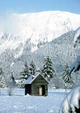
A snow-covered cabin we saw along the trail
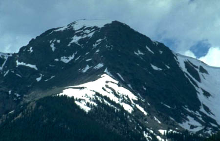
Snow covered mountains of North Carolina

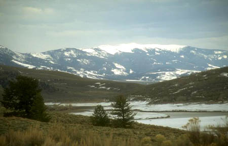
Charlotte, North Carolina
Vote Here:
101
Copyright © 2011-2024 by The Source for Learning, Inc. All rights reserved.