
Week of January 28, 2024 | View the Map
Right click and SAVE AS
to download the Google Earth file for this episode
Use free Google Earth software
to OPEN it, using File> Open.
Find more tech info here.
Thursday
We have gone to so many new places during this adventure. Uncle GT called us and told us to come here because, apparently, Louie made a credit card transaction at a gift shop in this park. That purchase was made two days ago, so hopefully, he is still here, and we can find him.
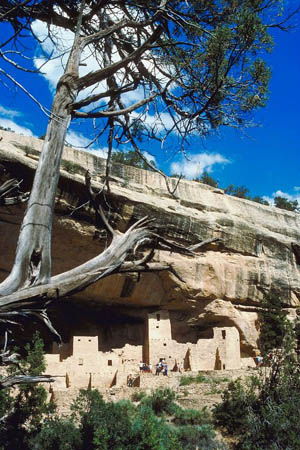
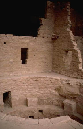
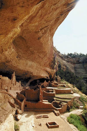
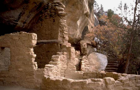
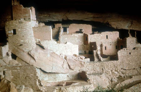
Mesa Verde (which means green table in Spanish) is a National Park in southwestern Colorado! It is so beautiful. The elevation within the park ranges from about 6,000 to 8,400 feet. There are ridges and valleys. We have been learning about the lives of Pueblo people who lived here long ago: A.D. 600 - A.D. 1300. Can you figure out how long ago that was? The park features over 4,000 archeological sites, 600 of which are cliff dwellings. We learned that cliff dwellings are houses made INSIDE of shallow caves and under rock overhangs along canyon walls. Holy Idaho! They sound so cool. We haven't seen any in person yet! Some of these cliff dwellings were large enough for about 100 people to share and live in together. Holy Idaho! Can you imagine living with 100 people?
Although the park is open year-round, the visitor's center isn't. There was a CLOSED sign on the door that told visitors that they could still shop for Mesa Verde gifts on the store's website. We are hoping that isn't how Louie made his purchase! We are not giving up yet! Since the shop was closed, we weren't able to gather a lot of literature. So much of our research has either been hands-on while we explored or done via Internet search. There is also a museum (Chapin Mesa) which we visited and learned a lot.
The weather has been fairly mild for wintertime. However, Mesa Verde does experience snow sometimes from October - May! During the summer months, it gets very HOT, and the park recommends that you drink plenty of water. Afternoon thunderstorms are also common during the summer.
Okay, we will update our blog later. We included some pictures of this breathtaking area below. We are off to explore.
- Meri
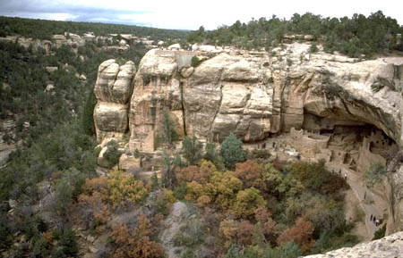
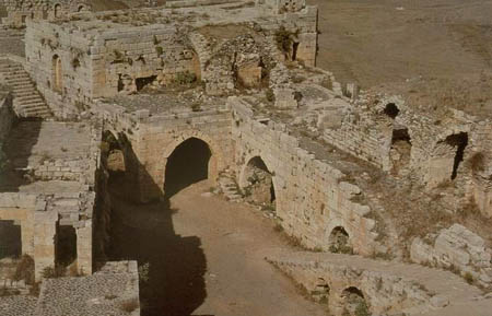
Mesa Verde
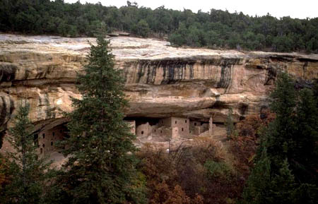
Another beautiful picture of the ruins
Another view of Mesa Verde
Friday
Mesa Verde became a National Park in 1906. Wow, so it has been a National Park for over 100 years! We also learned that Mesa Verde got its name (green table, in Spanish) because of its forests of pinon and juniper trees. There have been some fires in the past decade that have closed the National Park, but it is reopened now. Some areas still show some damage from the fires.
The location of Mesa Verde is very interesting. Although it is located in Colorado, there are 3 other states very close by. Take a look at the attached map and see if you can figure out what the other 3 states are that are close to Mesa Verde. There is a special name for the area where these states come together. Do you know what it is?
- Geo
Picture of a cliff dwelling we saw!
Another cliff dwelling
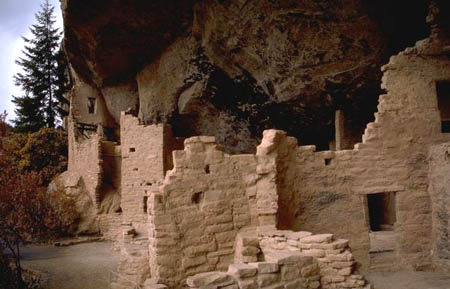
Another neat picture of a cliff dwelling
Map of Mesa Verde
Mesa Verde National Park is located near Durango, Colorado. What other states border this National Park? Hint: there are three. For a better view of the states and surrounding areas, zoom out on the map.
Sunday
- Meri
Mesa Verde (more pictures)
Map of Navajo Nation
Take a look at this map. What three states are included in the Navajo Nation? Which region of the United States is the Navajo Nation located in? How close is this area to the Mesa Verde National Park?
Power Paths
Here is a great site that Geo found all about power plants and Native American tribes. There is a lot to learn here! I bet I know why Louie is visiting the Navajo Nation. What do you think?
Solar Energy - The Future is Now
Wow! Here is another link (if your school allows youtube) that describes the solar energy possibilities in the middle of a desert. Do you think the Navajo Nation is in the desert?
Vote Here:
104