
Week of January 21, 2024 | View the Map
Right click and SAVE AS
to download the Google Earth file for this episode
Use free Google Earth software
to OPEN it, using File> Open.
Find more tech info here.
Sunday
We have been in Denver for several days waiting for news from Louie or Uncle GT. No word yet! The only text we have received was from Pandora telling us that someone called our house with an "anonymous tip" that the place we need to go rhymes with tornado? We have been researching places that rhyme with tornado and haven't found anywhere. We will update as soon as we hear. BRB
Okay, sorry I had to run, our cell phone just rang. Wouldn't you know it, that anonymous tip was actually for real. Uncle GT just called and told us that a Louie (no last name was provided) is set up for a speaking engagement about energy resources in Mexico. The speech is taking place in Texas. The city is called Laredo (which does somewhat rhyme with tornado). So now we are packing our bags and heading to Texas. I hope this is "our" Louie. Uncle GT wasn't sure, but he figured it was best for us to go check it out. After our last helicopter scare, Uncle GT has actually sent an agent to travel with us to Texas. I guess it is better to be safe.
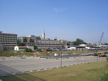
Take a look at the attached map. Can you find Laredo, Texas? What cardinal direction will we be traveling from Denver to Laredo, Texas? Do you notice anything that makes Laredo unique on the map? We also copied and pasted a picture of Laredo that we found on the Internet. OK, we better get packing. We need to walk to the convenience store for some masks for the plane.
Okay, sorry I had to run, our cell phone just rang. Wouldn't you know it, that anonymous tip was actually for real. Uncle GT just called and told us that a Louie (no last name was provided) is set up for a speaking engagement about energy resources in Mexico. The speech is taking place in Texas. The city is called Laredo (which does somewhat rhyme with tornado). So now we are packing our bags and heading to Texas. I hope this is "our" Louie. Uncle GT wasn't sure, but he figured it was best for us to go check it out. After our last helicopter scare, Uncle GT has actually sent an agent to travel with us to Texas. I guess it is better to be safe.
Take a look at the attached map. Can you find Laredo, Texas? What cardinal direction will we be traveling from Denver to Laredo, Texas? Do you notice anything that makes Laredo unique on the map? We also copied and pasted a picture of Laredo that we found on the Internet. OK, we better get packing. We need to walk to the convenience store for some masks for the plane.
- Geo
Map of the USA
Here is a pretty neat map that we found online. There is a lot of information (and even advertisements to ignore). Just look at the map! Can you find Denver, Colorado? Can you find Laredo, Texas? What cardinal direction are we going to travel? Why do you think Laredo is such a unique place? Clue: look south!
Monday
Holy Idaho! We arrived in Laredo last evening. It is amazing! Did you know that Laredo has a rich Mexican heritage and it is on the border of Mexico? We attached a link so you can learn more about the history of this incredible city! Laredo is located on the north bank of the Rio Grande Plains in South Texas. It is right across from Nuevo Laredo, Tamaulipas, Mexico. Geo says Nuevo means "new." I wonder why they would call it that. The Mexican Mountains are to the west. This area has a few hills and a lot of flat land covered with brush. There are grasslands, oak, and mesquite. I wonder if we will get to cross the border. The city's population is around 233,000 people.
Much of the economy of Laredo is based on the international trade with Mexico. That must be pretty simple since they are SO CLOSE! In fact, more than 47% of the United States international trade heading to Mexico crosses through the Laredo port of entry! Wow, Geo just told me that Laredo is the largest inland port in the United States. I wonder what that means. Geo explained it basically means that the port is located on an inland waterway (not having access directly to large seas or oceans).
The city of Laredo has a total area of about 80 square miles. I wonder how that compares to the total area of where you live. Nearly all of this area is land. About one square mile is water. I want to look at a map of someplace I know to see how big one square mile is. I'll have to use the scale to help me.
The climate of Laredo is affected by the Gulf of Mexico to the East, the Sierra Madre Oriental mountains to the west and the Sonoran Desert of Northern Mexico. Do you remember learning about the Sonoran Desert a few months ago? WAY back when we were in our own home town? Laredo has some interesting weather! It ranges from long periods of heat to sudden tornadoes or storms. For its location in south Texas (and being closer to the equator), Laredo is rather cool during the winter months. The average daytime highs are mid-60s, while the average overnight lows are in the lower-40s. Summer is warmer, with an average high of close to 100 degrees and an average low of 75 degrees. Laredo averages about 20 inches of rain per year and sometimes experiences a drought. How do you think this compares to the climate in Phoenix, or your home?
- Meri
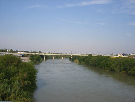
Rio Grand (known to some locals as Rio Bravo del Norte). http://www.flickr.com/photos/lordsutch/ / CC BY-SA 2.0

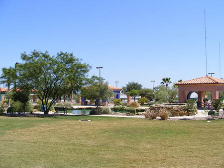
Interstate 35 at the Loop 20 interchange in Laredo, Texas. Look at the beautiful sunset! http://www.flickr.com/photos/fatguyinalittlecoat/ / CC BY 2.0
Tuesday
We have learned so much in the past few days here in Laredo. The bad news is that the Louie speaking in Laredo isn't "our" Louie. So we headed in the wrong direction. We need a new lead.
Email from Pandora:
What was the latitude and longitude for Laredo, Texas. And what does longitude and latitude mean again? It is confusing!
Pandora, we are going to answer right here in our blog so everybody can see it. The map coordinates for Laredo, Texas are about 27 degrees north (latitude) and 99 degrees west (longitude). Map coordinates provide the degrees of longitude and latitude so you can find the exact location of a place based on some known but imaginary lines on the earth. The lines that run up and down the map (north and south) are called longitude lines. These lines are used to measure degrees east or west from the prime meridian. The prime meridian runs through England, but mapmakers all know where it is. The lines that run across (east and west) a map are called latitude lines. Lines of latitude measure degrees via north or south. The equator is at 0 degrees latitude. This imaginary line marks halfway between the North Pole and the South Pole, and mapmakers agree on where this line is so they can include it as a way for everyone to find map coordinates. We also attached the drawings from our last blog entry to help you all visualize what these terms mean. Hope that helps! I think I am going to try drawing my own map so I can check whether I have these lines figured out. Maybe you should try it too.
Uncle GT called and is sending us to Mesa Verde now. Neither Meri nor I have a clue where that is! And we have NO CLUE why GT would send us there. We have a few guesses. We have to look up exactly where Mesa Verde IS! Why do you think we are going to Mesa Verde?
- Geo
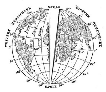
This picture shows the prime meridian, equator, eastern and western hemispheres, lines of latitude, and lines of longitude.
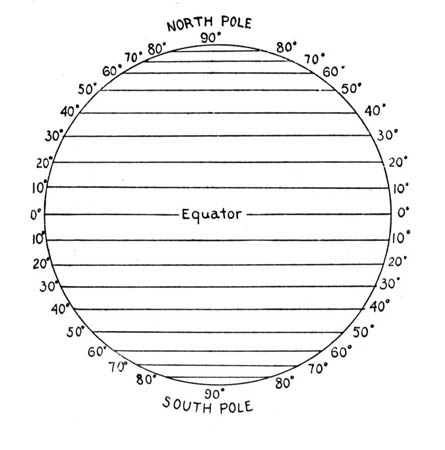
This picture shows the lines of latitude. Do you see the equator? The lines of latitude run across a map, but they measure degrees north and south from the equator. The lines of latitude are like the steps of a ladder on the globe.
Vote Here:
103
Copyright © 2011-2024 by The Source for Learning, Inc. All rights reserved.